
National parks
-
National Park Paklenica
National Park Paklenica
Paklenica National Park is a national park in the Velebit mountain range 30 km northeast of Zadar on the Adriatic and about 1 km from Starigrad. He was declared already in 1949 to the national park. The highest peaks are Vaganski Vrh with 1,757 m. i. J. and Sveto Brdo (1750 m. i. J.) Paklenica in Croatian means "little hell"
 .
.The name was probably due to the rough and steep karst cliffs, which are home to numerous hidden caves and sun illuminated the association with the underworld awaken. An alternative explanation bears the name back to the frequently occurring in the park Pine, whose juice (Paklina) previously used for impregnation of boats.
National Park Paklenica 27 The total of this national park is 96 square kilometers. The National Park provides habitat for numerous rare and protected species: brown bear, lynx, serpent eagles, griffon vultures live in the national park. In addition, numerous reptiles live in the Velebit: toxic horn vipers and adders come in karst Croatia relatively common.
To get to know the diversity of the Park provides 150 km of marked trails. In some areas, it is strongly advised them not to leave due to continue existing landmine danger. The tents are not permitted in the park, but some mountain huts and (free) shelters are the walkers available. Water is in the park and sufficiently available in drinkable quality.
Although the Velebit mountain has many beautiful viewpoints and varied hiking Rods to offer, particularly the large and the small canyon - Velika and Mala Paklenica - famous with locals and visitors because of its beautiful landscape. According to the area in 1978 and declared a UNESCO natural park and placed under special protection. This 36.5 square kilometer area near Zadar and Starigrad extends over 1758 meters and I especially with climbers popular since the steep gorges are each level meet while still represent a challenge. The part only 50m away from each other lying almost perpendicular Karst walls rise up to 500m and from any point, you have a good view of the Adriatic Sea, which is separated from the massif by a narrow coastal strip. But also for hikers and other nature lovers the National Park Paklenica is a worthwhile destination: leisurely trails reward with a fantastic view and in the protected territory of the park you have to observe the rare occasion some of the last wild vultures in Europe.
Information about the National Park Paklenica
- Geschichte
- Flora and Fauna
- Attractions
- Images
- Video
- Map
- Approach
Story

The Velebit Mountain and particularly the region of the National Park Paklenica have always been known among climbers.
The one studied here their sporting challenge that other published scientific papers to flora and fauna, the climate in this coast-hugging mountains or the geomorphological processes that formed the unique panorama. But only in 1928 the gorge was declared a national park, in the following year, this status was not reconfirmed.
Until the 90 years inside the protected area included just an area of 36.5 square kilometers, which was, however, been extended to its present form.
Today includes two gorges and a large part of the hinterland to the 102 square kilometers of natural park. Thus it is ensured since 1997 that up to 400 meters high cliffs, the fertile forest land and the unique panorama preserved for future generations in all its beauty.
Flora and Fauna
Flora

In the steep slopes and the overhang of the gorges hardly anything grows, extremely resistant grasses and decorative Alpenseidelbast can survive in the inhospitable environment. On the more moderate slopes contrast, offers a wide variety of Croatian vegetation: to sea thrive Mediterranean plants, the land side can discover the continental-alpine Bewachsung. With the foot of the mountains extend huge forests full of beech, oak ash, firs and pines, near the summit from thinned and more forestation and more floral and herbal plants found in.
Fauna
Because of the far inland hineinschneienden gorges typical coastal animals mix with the characteristic domestic fauna in the area of the National Park Paklenica. Especially many rare species of birds feel at home on the cliff walls of the corridors, here you can spy among others, the fence and the Schwarzkopf Ammer, coastal tree pipit and the nuthatch.
Who sees revolve too much swinging about himself lucky enough to
 experience one of the threatened with extinction toed eagle, golden eagle and the giant griffon vultures in the wild. National Park Paklenica 15 These scavengers are not only tolerated in the park, or see an attraction, they also fulfill a practical purpose: dead one of the sheep on the pastures of the mountain would be taken away for cumbersome, slow decay of the carcass on the other hand would lead to diseases among the surviving animals - and so does the vulture with this "feeding" the function of a "biological waste disposal".
In addition to the birds of the air space is populated by colorful butterfly species, the soil in the lower plains heard the lizards, snakes and tortoises.
In the forested areas can ever come across one of shy bears, wolves or wild cats that still live freely and blameless here. to discover your tracks in the jungle does not fall the expert trackers hard to get the animals themselves, however, to face a rarity - but that's many a perhaps rather SOA € | Zahmer and many are attendance chamois that you see on vertiginous ledges can.
They were once native to the mountains, but were domesticated or cut and exposed again in the 1970s. Since then they have their "new old habitat" developed largely and seem to enjoy the rich variety of sight sport climbers as well as vice versa!
Attractions of the National Park Paklencia
Hiking Trails
In eight hours, it can the experienced and fit hiker create vrh from the parking lot to the great canyon of up to 1758m high summit Vaganski.
In between, still take a short breather and a snack at the
 hut Lugarnica at 440m altitude and then continue the way through a picturesque creek and along the summit Crljeni kuk and Babin Kuk.
But this tight athletic program lets the beauty of nature and enjoy the unique scenery on the sidelines.
Once at the top you are particularly proud and exhausted - but the nicest missed. It is therefore recommendable to explore the park in several small stages.
The 150km trail routes are marked on the maps of the park administration.
Who does not want to run with all the other tourists.
Should not leave the park entrance, but continue to follow the road slightly to the large canyon into or go over in good weather in the small canyon and there looking for his way his car.
Here the trails are, however, largely left to nature, which can recommend a good equipment.
In the hot summer time you are looking for from the dry riverbed of a beautiful view of the slopes and the many white-headed geese greed here seclusion.
But when using the rainfall is a walk only with a good travel companion or after exploring the area in the dry state a good idea.
Manita pec
The most beautiful of mountain caves of stalagmites prevailed Manita pec and its impressive underground halls and corridors.

The largest discovered hall measures 65 x 40 meters and is 32 meters high.
Up to a depth of 175 meters, the natural vault has already researched and developed, so that it in July and August, and then include a week with a trained tour guides several times in the months before.
Registration for the tours - individual visits are not possible for safety reasons - taken note of the management of the park in the hotel Alan.
Villages
In rough area of the national park donkeys are often the only means of transport of. What visitors appears as rural idyll and homage to pre-industrial times, the population itself is often troublesome. The youth are drawn from the stables to the universities and so grow the big cities, while places like Jurline, Veliko Rujno and Ramici with its stone walls and grazing land for most of the year, leaving the natural park are.
Only to escape for the holidays and to the bustle of the city return especially the older residents like to return here. Few residents still live year-round in places like Marasovici where they but mostly waiting for hungry, thirsty and tired hikers and pursue no longer the extremely powerful exhausting farm work on the stony, rocky ground.
Panorama
Besonders schöne Aussichten genießt man bei einer Wanderung zum Vidakov kuk, wo Felsnadeltürme in die Höhe ragen und ihre Spitzen fast schon abzubröckeln scheinen. Kletterer versuchen sich an den schmalen Steinformationen, Wanderer können entweder zwischen ihnen einen Weg suchen und sich wie in einem versteinerten Wald fühlen oder von Starigrad aus den östlichen Wanderweg wählen und schon auf dem Hinweg die Aussicht auf die Rillenkarren genießen.
Eine Alternative hierzu bietet der Panoramaweg 5, der über die Babunjasa-Höhe in sanften Hebungen und Senkungen zu einem Weiler im Paklenica-Tal führt und einen einmaligen Blick auf all die Schönheit bietet, die diesen Park zum Naturschutzgebiet gemacht hat!
Climbing in Paklenica
Situated at the entrance of the large ravine near the parking lot, the climbers and those who want to be hit. In this relatively simple area safeguards are sufficiently attached to come slowly to the taste of the vertical movement.
A special attraction are the griffon vulture nests that are located above the climbing routes.
National Park Paklenica 42
 These regions are locked course for the athletes, but the circling birds of prey and their presence in Horst are for waiting climbing fans a welcome entertainment.
The further you advance in the national park, the more demanding are the routes: In the pension Rajina to professional climbers meet new routes or to place in the extensive archive to browse to the original reports of first ascents.
Renowned Freeclimber have left here valuable tips and researched for their own guide.
Peacefully and aesthetically are the routes on the west wall of Anica kuk, which, however, already require an hour-long Hinmarsches. At this 400m high cliff and courses are offered in the summer.
Those wishing to explore the connector, which already demanded some tragic victims, on their own, taking the best with his camping gear and distributed climbing and hiking tour over several days. Then Vidakov kuk, kuk Bojin, Babin Kuk and the walls of the small canyon but unique experiences and challenges in which you should watch only, not to overestimate his own abilities.
Images of the National Park Paklencia


Video
Map
Approach to the National Park of Paklencia

Well-developed motorway network in Croatia you drive to the coastal town Starigrad and follows from here signs to Paklenica.
Hotel Alan, where you can also live comfortably on multi-day visit, to find opening times the administrative center of the park and competent partner for questions, flora, fauna and everything else you want to know about the ravines.
From here a well-marked road leads to the main entrance and the beginning of the great gorge Velinka Paklenica. In the park itself there are numerous advertised roads and hiking trails to choose from.
On the one hand seems in Velebit mountain at 1840 hours per year, the sun, on the other hand here are much more violent and more frequent precipitation than in the coastal regions recorded. In the heights it sometimes causes the summer to fog banks and the temperatures are usually lower than those of nearby cities.
Therefore it is advisable to also take in the sunshine and supposedly brilliant weather a sweater or rain jacket with the hike. With luck, you can even repurpose exclusively as picnic blanket!
-
National Park Risnjak
National Park Risnjak
The National Park "Risnjak" is located in Gorski Kotar, the most forested area in western Croatia. The park, with a surface area of 63.5 km2, comprises the central part of the massif of Risnjak and Snježnik, and the upper reaches of the river Kupa with headwaters.

The area of the Risnjak - massif was declared in 1953 on a proposal from major Croatian naturalist and explorer of Risnjak, Prof. Dr. Ivo Horvat to the national park. In early 1997 the NP "Risnjak" has been extended to the territory of the massif of Snjeznik and the source of the river Kupa, which the desire of Prof. Dr. Ivo Horvat, to protect and enhance this area, has been fulfilled.
National Park Risnjak The territory of the NP Risnjak belongs to Dinarics which stretches from the eastern Alps to the Sar-Pindos Mountains, and this is part of the area which connects the Alps and the Dinarides. About the massif of Risnjak and Snjeznik to large migrations of Alpine have moved to the southeast, but has maintained in these mountains a vegetation substantially different from that in the Alps.
The National Park Risnjak - Nacionalni park Risnjak is located in Gorski Kotar near Rijeka. The name part Ris called Lynx, who still lives here in the woods.
The Paths to the Veliki Risnjak
The main goal of most visitors to the park is the peak of Veliki Risnjak. Until the country cottage is located at the top, and the "Sloserov dom", named after the botanist and the first Chairman of the Croatian Mountaineers Federal, Dr. Josip Schlosser Klekovski called, perform some marked mountain walks. From Bijela Vodica there are even two of the first- "Horvatova staza", slowly increasing the forest road until the junction Podi up, continues alongside the Vucja jama, Klupice and the ruins of Stara Lugarnica, to the important crossroads for landmark 51. From there from an ever steeper expectant path leads to the mountain hut. Another path leads without climb through the Leska Valley to Klada source, and then some with wooden stairs to the intersection Markov brlog on the street about Leska. From the junction it goes to the west next to the Zelena Ponikva and through the rock arch Janjicarska vrata the intersection Medvjeda vrata, and then right, through the Mali Juzni Risnjak mountain hut. The climbers to the summit of the Risnjak of Tuhobic about Lepenica, Osoje and Gornje podolje on the Rijeka - ascend climbers transversal (RT), enter in the park from the northwest side of Suha Recina, and then come over Medvjeda vrata to the refuge.
The Paths towards the Kupa-source
The source of the river Kupa, as a hydro-geological feature and one of the pearls of the NP "Risnjak", attracts many visitors. The main entrances to the Kupa-source drove in two directions. The first comes from the village Razloge wherever you via a narrow Asphaltsraße that near Malo Selo from the street Gerovo - may teeing Crni Lug, by car. From the village Razloge the path leads steeply downhill towards Kupa-source then removed for 30 minutes. The second main entrance leads from the village Kupari, where you can come across a winding paved road by car. This road is achieved when one of the asphalt road Mali Lug - turns Zamost. From Kupari a mountain path leads which first on the Kupa-source increases, resulting in the river bed of Krasicevica downhill, and then the source itself is only 5 minutes away. On this path is followed by the ways of the Croatian and Osilnica.
Information about the National Park Risnjak
- History
- Flora and Fauna
- Geography
- Images
- Video
- Map
- How arrive
Story
1953 National Park Risnjak was founded at the initiative of the naturalist Hovat. It is important to keep in him the impressive coincidence of two mountain ranges and a river course and to ensure the natural development free from obstructions and modifications. At that time, the park area was just 32 square kilometers, the passage of time but it has been doubled. Only 10 kilometers away from the Adriatic coast at an altitude of up to 1525 meters is today one of the most popular recreation areas of Croatia. Through small settlements directly at the park longer stays are here the rule rather than the exception and who takes a walk in the long snowy winters between the peaks of the Dinarides would hardly surprised here the idyllic, untouched by human hands home of the legendary Yeti found to have.
Flora And Fauna
Flora
Between June and July of Risnjak blossomed in all its colorful blooms, especially the upper zone, inviting to the mountain huts to enjoy sporting outright with new color and Fomvariationen, fragrances and designs. Here you can still find edelweiss (please do not pick!), Orchid, Clematis alpina and tiger lilies. The Alpenrose, gentian, violet and rockrose are found here as well as hundreds of other species, all of which even did not fit in a single bouquet itself. As early as 1953 were 872 different plants documented in the grounds of the park so that one even in days spent always a new natural beauty is striking.
 Above the meadows fighting the mountain pine from the wind and rock, below the glades are the dense forests that motivated you to declare this area a nature reserve: In just 30 square kilometers created the influences of the Adriatic coast weather, continental climate, the Dinarides and the Alps a unique forest landscape. In 55% of the total park area, the beech and fir forest extends up to 1200 meters. In the shadow under the crowns grow plants such as Christmas rose and reed grass, moreover, sycamore, elm and spruce are represented sporadically. The higher one ascends the summit in the forest, the smaller the trees and the more crooked the tribes.
This is due to the weather: Since regular thick layers of snow are piled here in winter, the young shoots grow in the dark until straightforward, so the 90-degree angle to the ground, but then turn to the light and the sun. But the growth turns out because of the inhospitable soil and severe winds far more difficult than in the valley - and so the trees stay so small that the book as a shrub, a so-called "krummholz" appears. In protected Leskatal contrast, fir shoot at up to 45 meters up, a diameter of not infrequently have a meter and would donate more than 1000 cubic meters of wood - is likely to beat them since.
And here is the tendency deterrent geography of Risnjak only of advantage, because due to the inaccessible location, there are still some areas inside the reserve that were never cleared or otherwise used intensively for agriculture. The "forests" of Croatia, however, are only scientists accessible to allow her beautiful natural state is not jeopardized by discarded chewing gum papers, blumenpflückende romantics or trampling tourists - at least not until all the secrets of the forest are researched and then these reserves are revealed for the eyes of the public .
Fauna
Depending on the plant occurrence also varies the type and number of people living in the park animals. To nest as only 72 of the 97 bird species on the terrain of the Risnjak, but already represents a significant achievement in environmental protection - elsewhere can be much less talk of biodiversity. In Subalpine Buchenwald are woodpeckers, chickadees and Redstart. In the regions including for example, is the rare hazel grouse native, about the crooked timber inventory also live the annular throttle, the Dunnock or about the black redstart.
 And live near the summit in the rocky plains and nest eight different prey types. In the Kupa also live mullet, trout and minnows, the cold water temperatures just feel comfortable in the 5-6 degrees, and out of sheer insolence often go legitimized by the park administration anglers in the networks. The mammals are represented as extensive in the park: deer, chamois and small game inhabit the slopes and enjoy the hikers already by their mere presence. Rare to discover are attendance predators. Around the Risnjak located lynx, wolf and brown bear have settled, and one or the other boar roams the mountains. Since the park has a fairly small area, the animal population of the park is also an example of the fauna of his surroundings. Since there is no built boundaries between Park and surrounding areas, it attracts a lot of animals foraging in the unprotected valleys where they are fair game. Therefore, the park administration has set up regular feedings not to domesticate the wild but too long hikes to make unnecessary and thus to protect the stock.
Geography
A few kilometers away, parallel to the coast, the mountain range Dinarides runs through the Croatian hinterland. Some of it makes from the Gorski Kotar, whose highest peak is again the mountain Risnjak. The 1505 m with slightly lower and 3 km away Summit Snjeznik is also one of this terrain as the valuable high forests between them, the large farmland and idyllic clearings on the slopes of the two mountains and its surrounding peaks.
However, only an area of just 32 square kilometers has been a national park rings awarded to the mountain Risnjak on scientific criteria, which was, however, extended in 1997 after tourist and economic considerations on the double degree, so that the mountain range Snježnik and the source of the river Kupa also are protected. The entire park is located about 300 meters above sea level, the landscape is ideal for hiking and so meet here leisure and environmental protection successive desirably harmony.
The summit of the reserve consist of Jurassic limestone, so as to form the typical karst formations with craggy rocks and trough-like valleys. The carbon-containing soil takes rainfall on quickly and a varied vegetation can be seen from him. Although this is always moist soil passes on its surface a single drop in a large stream, but can within the earth, the water in the Kupa and into the Black Sea incorporated.

The Kupa itself that determines not only the border of the National Park Risnjak but also that of the State of Croatia, rises to 313 meters above sea level a 80 m deep, underground source that initially forms a 50 m wide lake and then over 5 km and inside with first rapids National park passes. The klime in the National Park of course strongly depends on the height from, on the one measures, but generally speaking rainfall are here quite frequently and violently, no winter passes without the park lies there sweetened in snow.
At the top there are in July average of 12.6 degrees, in January 3.3, so that up to 4 meters high snowpack takes almost half a year here to melt.
But with a humidity means of always over 80% already has the Risnjak almost tropical values. This rare combination leads to the unique flora and fauna which must be protected by means of the national park.
Photo


Video
Map
How arrive
From Zagreb follow the old road or the direction Rijeka motorway, but turn early from Delnice. The place has its own station, so that traveling by train is possible. From here it is about 12 kilometers to Crni lug, a picturesque town, which marks the entrance to the park and in the management of Risnjak is situated.
The staff is available during the opening times for personal recommendations and answer questions, guided tours can be booked here and all sorts of information are sighted.

From here you can on several trails the national park and especially explore the Leska Valley on your own. Who but comfortable like traveling by car on the road between Zagreb and Rijeka to the exit Gornje Jelenje and follows the forest road towards Vilje about seven kilometers.
Right a poorly-developed Stichweg leads to a parking area from which you reach the top in a short walk. Those arriving from the north reaches the Park easiest on the road between Gerovo and Lazac, from the West controlling first the village Platak and then continues its journey on foot to the south flank of Snjeznik along an old Roman path or take the trolley again direction Gornje Jelenje continued.
Tips
Locally Bijela Vodica the nature trail Leska starts. about 4 km explain twelve panels and extensive information subalpine forest, the most important rock phenomena and raise awareness of the endangered wildlife of the region. Following this, the walk can be extended to a real hike: Up to the summit you need a good half day if you enjoy the view of the mountain shoulder Schlosserov and perhaps would like to stop off at the local lodge, the longer. For the top of the mountain you should but - in spite of well-marked and regularly serviced ways - put absolutely professional hiking shoes and sufficient not forget drinks and sunscreen!
Although you should not get a Lynx to face on your trips: These shy and rare animals are represented here abundantly - not least in the name of the park: "crack" means in Croatian "Lynx" and the mountain Risnjak was probably named after these creatures. But precisely because they were so numerous that hunting was easy on them, was so spotted and shot mid-19th century, the last of the original lynx population. But today, there are so many of these again Wildcats here is not to owe about an artificial settlement but is independent from Slovenia immigrated animals.
Activities:
- A walk on the nature trail "Leska" (4,2 km). The trail begins at the administration building in Crni Lug and takes about 1 hour 45 minutes.
- A hike to the Kupa-source. The ways to Kupa-source can be found on the official website of the National Park.
- Mountaineering and Trekking
- Routes towards Veliki Risnjak and Snjeznik visit the official homepage of the National Park.
- mountain bike
- ski
- Sport fishing is possible from early April to the end of October to pay an additional fee of 150.00 kuna.
Events:
The Risnjak Mountain Trek - A competition in which a specified distance must be overcome with checkpoints. Equipment and meals are provided. basic knowledge of trekking in nature are necessary for participation in the race. Every year the route is changed. The competition takes place in the summer.
Eko-days - These days local organic produce will be presented. -
National Park North Velebit
National Park North Velebit
The National Park North Velebit (Croatian: Nacionalni park Sjeverni Velebit) was declared in 1999 a national park and is located in the northern part of the Velebit mountain massif near the town of Senj on the Adriatic.
The area is 109 square kilometers. The National Park offers superb views, high climbing cliffs and numerous caves.
In 1992 there was Lukina Jama (Luke Cave) discovered the previously deepest known cave in South Eastern Europe (1392 m). The region with its magnificent karst formations is a worthwhile destination for hikers with the long-distance footpath Premužič staza, climbers (i Hajdučki Rožanski kukovi), speleologists (Lukina Jama), botanist (Botanical Garden on Zavižan) and nature lovers in general.The National Park is within the biosphere reserve "Velebit Mountain" by UNESCO. The widest part of the Velebit extends from the Vratnik Pass (698 m) on the road Otočac-Senj to Veliki Alan (1379 m). to bare rock above the Velebit Channel pile up on the sea side and the land side extends a wooded plateau.
On Zavižan (1594 m) is a mountain lodge and a botanical garden; an excellent starting point for cycling and horseback riding; a challenge for experienced mountain bikers, climbers, fliers and speleologists. The ridge path "Premužič staza" leads through the reserve Rožanski kukovi and by the strictly protected reserve Hajdučki kukovi and offers magnificent views of the sea and the islands to the island of Rab.
INFORMATION ON THE NATIONAL PARK
- Photos
- Video
- Panorama
- Map
- Getting there
Photos


Video
Map
Getting There
The easiest arrival route crosses the town Otočac. You can reach Otočac by taking the highway Zagreb-Split or use the highway that crosses Josipdol towards Senj, and drive over the Kapela pass. From the highway, take the road to Krasno, where the building of the park administration is. Another arrivals is the road to Štirovača, leading to the south-eastern part of the park. If arriving from the coast, there is also a road from Jablanac, but which is rather not recommendable, because it is very narrow and tight. Should you choose this route, you reach the park from the southwest at the Alan mountain lodge. In addition, the park can be reached on paved roads through the villages Mrkvište, Ledena Draga, Begovača and Štirovača. And if you want, you can take the trails from the coast, and this for direction Brisnice and Gornja Klada.
The Hajdučki- and Rožanski kukovi nature reserves. Where the rock group the Rožanski summit is slightly more accessible than the difficult terrain of karst rocks of Hajducki kukovi. The landscape is wild and inaccessible and there are still many places that were hardly ever entered by people, and therefore still preserve the aura of the unknown and unexplored. In 1993 here the Lukina Jama was discovered a cave that the deepest cave in Europe is with a depth of 1392 meters - and the world is on the eighth place of the cave depth.
- The pastures of Veliki Lubenovac - A beautiful terrain near the Hajdučki- and Rožanski kukovi nature reserve.
- The Premuzic path - He performs the most beautiful and interesting parts of the park
- The Visibaba - A botanical reserve.
- The steep slopes of the Zavižan-Balinovac-Velika kosa, a strictly protected botanical garden.
- The Borov vrh forest reserve.
Interesting events:
The International Mountain Day on 11 December.
The celebration of International Day for Biological Diversity on 22 May.Accommodation:
The National Park Sjeverni Velebit offers basic accommodation in mountain huts. In the town of Krasno you can also find hotels and private accommodation.
Refuges:
Mountain lodge Zavižan (20 beds), where you can stay and there is also the possibility to cater for yourself (eg. As tea, coffee, beer and simple food). During the tourist season, you can also ride.
Mountain lodge Veliki Alan (46 beds 5 rooms) .You located in the south-western part of the park and can comfortably either on foot, descending, reaches from Premuzic path, or by car from the coast from Jablanac. In the Alan mountain lodge visitors can find also food. You can register here recover and prepare for the onward journey to the coast, or you continue walking on the Premuzic path. Here www.plsavez.hr / hr / Planinarska_kuća_Alan for details. -
National Park Brijuni
National Park Brijuni
The National Park Brijuni (ital. Brioni) is a small archipelago in the Adriatic.
Fazana view to Kornat
 i Iceland CroatiaSie lies off the coast of the historic region of Istria only a few kilometers from the coastal town of Pula. The island group includes 14 individual islands. The total area of the park is inclusive of the surrounding water areas 36 km². Only the largest island, Veli Brijun, has hotel facilities and can be visited freely. On the other islands are partly state-owned and private property, which are guarded. The Brijuni Islands are known for their scenic beauty and variety. The entire archipelago is protected. The Brijuni National Park was established in the year 1983rd On Veli Brijun there is an extensive vivarium.
The Brijuni Islands can be reached via ferry connections of Fažana or from Pula. The creation by private boat is only allowed in the port of the main island. In addition, diving is permitted in the National Park by licensed diving centers.
Information about the National Park Brijuni
- History
- Flora and Fauna
- Images
- Approach
- Video
- Nationalpark Brijuni Map
Brijuni National Park History
There are remains from all eras - from dinosaurs that have left several places of the island their tracks. There were theropods, like the Allosaurus. The islands were inhabited in advance cians time. Archaeological traces suggest a first settlement to about 3000 v. Chr. Out. From Roman ruins in Val Catena Bay / Uvala originate Verige. At a length of over one kilometer, the largest villa spreads there maritima of the Adriatic Sea, which originated in about Claudian period of two well late republican villa rustica. A large terraced residential buildings, a small temple area with three temples, a library, cisterns, a public bath (balnea) and a service wing with wine or

Oil production facility; in later times was in the ruins of a dyeing. On the archipelago can be found in the Augustan period seven villa rustica and a saline and a quarry. The Byzantine Castrum of Val Madonna emerged also from a villa rustica, serving from about the 5th century as the only fortified settlement on the island to protect against pirates. Nearby there is the early Christian basilica St. Madonna and the remains of the Church of St. Peter. In the central area there is a castle from the Venetian period with a defensive tower and the St. Germanuskirche with copies of frescoes from Beram and Glagolitic writings. Until 1797 Venetian the islands were part of the Austrian Littoral. In 1866 gathered Admiral William Tegetthoff the Austrian fleet in the port of Fažana and led them out from there in the naval battle of Lissa (today Vis).
In 1893, the Austrian industrialist Paul Kupelwieser bought the islands and made them habitable. The reason for the "uninhabitable" was the disease malaria. Kupelwieser read in a newspaper that Robert Koch wanted to do in Italy research on malaria. He wrote him a letter then and explained the situation on the island. 1900-01 attended cooking the island twice. As carriers of malaria identified cook the Anopheles mosquito. The malaria eradication was carried out by a number of actions, namely the vaccination of the people on the island (V. A. workers who z.T. came from the penitentiary of Capodistria, and of course the inhabitants) and the rehabilitation of ponds by Petroleum. This prevented the proliferation and therefore favored the reduction or migration of the mosquito. Even today, a monument commemorates Robert Koch's visit to the island (by Joseph Engelhart 1902).

Kupelwieser placed in the old quarries on footpaths and protected "Bora Platzln" operational agricultural and dairy farming ( "Imperial cheese") and viticulture. Alois Zuffar was responsible for the botanical features, its pine and cypress trees rejoice today to visitors. Anton Gnirs made outstanding contributions to the excavation of Roman remains. Kupelwieser imported exotic plants and animals, built hotels had to build a submarine water line, relied on modern technology and made the island (Bahr 1908: "I have always wanted an island and always found only islands, until I came to Brioni ... ") at a fashionable health resort. 1913 was the first Winter swimming pool at the Austrian Adriatic. In the period before the First World War they were a meeting place for the nobility, industrialists and the upper middle class, numerous artists visited the island. Tennis, horses, swimming and sailing, a natural aromatherapy, the salty, dust-free air ensured a good recovery. Many regulars remained several months each year. With the help of Carl Hagenbeck he planted a zoo with monkeys canyons, an ostrich, enclosures antelopes and a pond with flamingos. During World War I, the island submarine base of k.u.k Navy.
From 1918 to 1943 Brioni belonged to Italy and became an international meeting place for sports enthusiasts: the then largest golf course in Europe, polo, regattas. The complex attitude of Polo horses for any interested guests then led together with high taxes to financial difficulties, which resulted in Paul Kupelwieser eldest son Karl shot. It continued to slide, to the Italian State took over the debt-ridden island. After the surrender of Italy in 1943 the Germans came. Therefore, the islands were bombed in 1945 - almost all buildings in the port area and the seaside resort Saluga were destroyed, the Hotel Neptun 1. Large losses also contributed Neptune III thereof. After World War II the islands came to Yugoslavia and were as well as the largest part of Istria region of Croatia.
From 1947 to the Yugoslav state and party leader Tito had forbidden here one of his favorite residences, the entire archipelago was thus for the ordinary population. The remains of the old buildings were z.T. demolished z.T. constructed and newly renovated. Tito popular and frequently received on Brijuni state guests and numerous Hollywood stars. 1956, the then President Tito also signed the agreement establishing the Non-Aligned Movement with the presidents Nehru and Nasser on the island, which is thereby called Brioni declaration.
After Tito's death (1980), the islands were a national park. The Veli Brijun continues to be used by the Croatian government for state receptions and the summer residence of the Croatian President. On Veli Brijun the 10-day war in Slovenia ended with Belgrade with the Brioni Declaration in 1991st
Flora and Fauna

On the islands there are about 680 species of plants, many of which are endangered in the rest of Istria and can develop freely. Well known are the large oak forests. In addition to various indigenous Mediterranean species such as holly, myrtle, strawberry trees, bushes have, manna ash or broom nations live here also imported species such as pine, various pine and cedar as Cedars, eucalyptus, fir, redwood trees or cypress. Also exotic plants such as palms and cacti are planted generously.
A special attraction is the so-called. Ancient olive tree. With the C-14 method has been found that this is approximately 1600 years old.
Much of the vegetation at the Brioni islands has Mediterranean characteristics. The main plants categories on Veliki Brijun are:
Macchia
The ecological differences of locations defying (surveys, sunny location, soil, constant influence of the sea), occurs in a large part to Veliki and Mali Brijun on a process called Macchia vegetative stage of the forest. The scrub is found on all the islands. On the smaller islands it occurs entirely on the forest types already mentioned. Because of living on Veliki Brijun Wilds maquis is partially changed here. The most beautiful Macchia is up to 8 meters high, thick and impenetrable, and on the Peneda peninsula (Veliki Brijun) and the islands of Vanga, Madona and Mali Brijun found unchanged. This scrub is one of the most representative scrub areas of the Mediterranean.
Mediterranean Plants
Besides oak, there are other important indigenous Mediterranean plant elements, such as the large-leafed stone Linden, arbutus, myrtles, oaks and mastic trees, heather and flowering ash.
The twining sarsaparilla, butcher's broom, the Asparagus which Dioscorea communis and the Mediterranean Wildrose make the forest almost impassable.
Strawberry Tree - Arbutus unedo
Family of ERICACEAEA Mediterranean plant that is located by a beautiful evergreen shrub or small tree. It grows as an ornamental plant of the maquis in many places on the Adriatic coast. The greenish white flowers develop into a rich and beautiful resplendent bloom October to November. The orange-red round fruits that resemble strawberries, are uneven and dense with absorbed at the surface. Nutlets seeded. The fruits are not particularly tasty, and are not particularly valued in our coastal areas. Consuming a larger amount fruits causes digestive problems and is almost a drunk equal. Even the ancient Romans knew the effect of these fruits in the enjoyment in larger quantities. The name "unedo", an ancient Roman term for this berry is, translated by Pliny "unum tantum edo" (I eat only one).
On the Brioni part of the fruit is processed into brandy.
Myrtle - Myrtus communis
Family of MYRTACEAE
Myrtle originates from the East, and was brought in prehistoric times in the Mediterranean countries. In the ancient peoples was this lovely aromatic plant, as well as the laurel, sacred and highly valued.
It was also widely cultivated. As sprawl it grows only in sunny and warm coastal areas because it is sensitive to cold. The plant flowers in July and August with five white and delicate, pleasant smelling petals and much pollen.
Their berries ripen in November. Myrtle berries have a pleasant, sweet, aromatic and somewhat resinous flavor. The ancient Athenians they ate fresh, and in ancient Rome they were used as a spice and digestive drink.
Oak - Pistacia terebinthus
Family of ANACARDIACEAEOther name: turpentine-pistachio, terebinth pistachio turpentine.
A branched to 10 m high deciduous shrub with aromatic, resinous odor and a rich beautiful crown. The leaves grow alternate on a 20 cm long stem, pinnate, consisting of 5-11 elongated oval, uniform at the edges of leaves that are dark green and bright on the underside of the top. occur on the leaves frequently resembling of carob gall caused by insect bites. The tiny greenish flower buds develop into long straight grape-shaped flowers from April, coinciding with the leaves.
The oak is a Mediterranean tree which is to be found here in the bush and in the undergrowth of the coastal region. It grows in dry, warm and rocky areas from Istria to Albania.
The fruits of the terebinth pistachio are non-toxic and can be eaten in raw state, and have a bitter and astringent, resinous and aromatic flavor. The fruits are some places used as a remedy for constipation. Earlier, the young shoots were cooked and eaten this plant.
The old olive tree
Olive tree (lat. Olea eurpea mill.)
The old olive tree is one of the oldest olive trees in the Mediterranean region. This is confirmed by studies that have been made to a wood sample of the old olive tree by the Institute Ruđer Bošković in Zagreb in the 60s of the last century. By means of the method of carbon analysis (by applying radioactive isotope of carbon C14 on the sample a piece of wood from the root collar of the trunk of the olive tree) an age of about 1,600 years was found.
In the 70s of the last century, the olive tree was broken by a storm into two parts. The incurred as a result of the bursting of the strain wounds were concrete conserved (a time in the Arboriculture very popular method for preservation).
The treetop has a bird's-eye 22 x 8 meters, with a height of 6 meters.
The olive tree is still fertile, thus throwing off fruit from which oil is produced.
The harvesting of the olives takes place in October, and an average of about 30 kg will be harvested. From the 30 kg of olives about 4.1 kg of oil resulting in average in the quality extra virgin (certificate of the chemical components in the laboratory of the Institute of Public Health of the city of Pula). The best chemical analysis showed 0.11% free fatty acids, the peroxide value was 1.95.
The olive tree is an integral part of the unique landscape of Brioni and are, with its lush and rich treetop and the impressive extent of his tribe, a distinctive image in this micro location, in which it is located, from.
Invasive species
In addition to the native (indigenous) species, the plant population of parklands and avenues still styles complemented by numerous introduced (allochthonous): pine, Aleppo pine, western Mediterranean pine, Turkish pine, black pine, Atlantic cedar, Himalayan and Lebanese cedar, Greek and Spanish fir, redwood, cypress, eucalyptus, among others
Exotic plants are mainly grouped around the villas and hotels and been planted (palm trees, yucca, cactus, among others).
Forests

The community of oak forests are found in their typical composition in some places of the island of Veliki Brijun (the most beautiful area is east of the White Villa), where there is also on Mali Brijun a small community of oaks.Holm oak - Quercus Ilex
Family FABACEAEThe oak is also called Green Oak because it is an evergreen that has spread from the southern coasts of Europe to North Africa. The tree grows up to 25 meters high, has a short stem, its scope can be more than 1 m, it has a large, oval and thick crown. The bark is gray and smooth in young plants, however, is split open in the elderly in almost square plates. The leaves are simple, arranged alternately, leathery and remain even 2 - 3 years on the tree. The flower is the glans, which is small and up to half a consisting of hairy scales fruit cup (Cupula) covered. The acorns of oak have all acorns the largest energy value and the least tannic acid and are therefore also suitable for eating. About the palatability of acorns there are details in works of several ancient writers. Pliny writes, for example. That the glans tastes best when it is baked in ashes. Just the acorn of oak has been sung by the poet Mavro Vetranović, which she held for geschackvoller as the chestnut.
Oak forests are represented along with the laurel trees most common in the eastern part of Veli Brijuns. Nowhere on the Croatian coast there are such common areas of mixed forest stand of oaks and bay trees, which is one of the greatest curiosities of Brioni. On the lower floor of this community also grow the strawberry tree and the Moreton Bay privet.
Landscape park
Much of the open grassland, built on former agricultural land that existed in the past, long and were then abandoned because of the increasingly diminishing population (illness, emigration ...). During the work on the redesign of Brioni in a modern tourist area (from 1894), a part of the indigenous scrub and bush forest has been reduced, but remained the largest and most beautiful trees and holm oak groups unaffected. Some of these trees are now prime solitaires, so secluded trees (with canopy of up to 20 m), featuring individual clearings and lookout points and give them their identity. The game provides the ordinary appearance of these trees, which take the form of an "umbrella" (up to a height of 2 m there are no branches, because the wild the leaves and young shoots ablaubt), better than it could ever do a gardener.
Fauna
 About 250 species of birds, such as cormorants rare, can be found here. In a Saline a bird sanctuary was established. can be found on the island of hares and imported deer and European mouflon to wild mammals. The island is populated by countless peacocks, lizards, Käutzchen, gulls and cicadas.
There is also an ethno-park where a typical Istrian farm with Istrian ox (Boškarin), Istrian sheep (Pramenka), donkeys and goats will be presented.
One of the biggest attractions of the islands is the Safari Park at the north end Veli Brijuns; Since 1979 here elephants, llamas, zebras, nilgai, Somali sheep, Indian holy cows, donkeys and ostriches are presented. After the elephant Sony died in the spring, his wife Lanka alone. Star Island is Tito Gelbhaubenkakadu Koki, who can still laugh so and cough even 30 years after the death of his master as he.Animals in the wild
The hare (Lepus europaeus sp.) Was found on the archipelago, and 1902-1908 brought to the Axishirsche (Aksis Aksis), fallow deer (Dama dama) and mouflon (Ovis musimon) on the island, so that their descendants today the crowning of forests, parks and glades of Brijuni are, as well as a part of his identity and the overall experience of its visitors.
Reich represented is also native birds. Individual smaller islands are exceptional habitats where gulls and terns nest, and rare species of shag. The Brioni are a very important season conditional residence for northern bird populations, and here is the location of Saline is very interesting. It is a very humid room with three marshy ponds and an area of about 8 hectares, which is fenced to protect this ornithological reserve. Much surrounded by reeds lake provides good conditions for the breeding of throttle warblers, purple chickens mask barn owls and wild ducks. In the mud and shallow water the birds find insects, mosquito spawning and Gambusien so little fish, which have played a very important role in the fight against malaria at the beginning of the last century. In this inclosed space to ground plants and low plants can develop undisturbed because there is no influence from the Wild here, so this habitat for various Warbler, nightingales, thrushes, willow warblers and other songbirds is ideal. In the treetops of pine hawk, hawks and buzzards build their nest. Of the other birds of prey can be seen regularly the marsh harrier and the hen harrier. With the end of the summer and autumn come various spa located on the transit of birds in the Saline, which then continue on their way south. In August you can see Gadwall, Wigeon and spoonbills, egrets diving, pintails and teals. Of the herons can be the little egrets, herons, the purple heron, the Squacco Heron and the Night Heron encounter.
The presence of large egrets, black storks and bitterns indicates that this habitat is also meaningful for rare and endangered species of birds, as they not only peace will also find enough food.Safari Park
In the northern area of Veliki Brijun a safari park in 1978 in a fenced area in the size of 9 ha furnishings, home to exotic herbivores: Indian elephants Sony and Lanka, llamas - of South American camels which according to an Indian legend during the earliest epoch been tamed of human existence, zebras, Nilgaus and kob antelopes, Somalian sheep and Indian holy cows and typical donkey.
The Nilgaus or nilgai are a gift from India from Nehru from the year 1959th
Often the benefits of Antelope be described with just three words: fast, timid and lovely animals. In Africa, they are regarded as "faster than the wind, and incredible like a dream". From her big eyes with long eyelashes they also exude a gentleness, timidity but fear of a tracker off. Your real home is Asia, but today they are spread across Africa: in the plains and savannas, jungles and river valleys, and even in the mountain slopes. The Arabic name for the antelope means "flower eye". The strong nilgai are the only representative of large antelope in South Asian soil. The origin, this is an Indian antelope. Because of the dark blue color of the male They are also called Blue Antelope. They live in small herds, the males kneeling during a fight on the front legs. The females give birth to 1 to 2 cubs.The Kob or Moorantilopen are a gift from Zambia in 1962 from Kenneth Kaunda.
It is an African antelope, with yellow-brown color in males and females. For the males, the 70 cm long sharp horns are characteristic, and particularly graceful attitude they owe the relative to the front part raised rear part of her body. 40 males and females together in herds - in their natural habitat live 20. The females are already sexually mature at 2-3 years and take each one offspring.The Somali sheep, are a gift from Ethiopia from 1959. Your actual home is Asia, but they are spread to Europe, Africa and the northern parts of America. Each mountain range in Asia has one or two specific types of sheep, and so was also the Somali sheep. They are mainly dark colored, but dominated the dark brown color. The rams long hair under the strong neck and down curved horns while both the horns and hair are short in females. Rarely calves two cubs. The sheep live in large herds.
Since the animals in Sararipark move freely and the common life has played its part, was born on 05.03.2003 also Brionko the light of day, a young calf, which is a mixture of Somali sheep and mouflon. A lovely specimen of a rare, probably unique case, an ever taken place pairing between a mouflon and a Somali sheep.Llamas are South American camels, and differ from real camels by a smaller body and a relatively large, very compact head with a pointed snout, large eyes and slender legs, with more cloven hooves. The Lamas have only one hump, and her hair is long and woolly. They live in the highlands of the mountain range Cordillera up at an altitude of 4500 m. From their wool manufacture the Indians always blankets and ponchos.
The steppe and mountain zebra (Equus quagga and Equus zebra), came as a gift from Seku Ture from Guinea 1960 and 1961 by Brioni. An ancient Latin writers reported that the Roman emperor Caracalla n in 211th BC. Except tigers, elephants, rhinos, also a "tiger horse" sent into the arena, and it killed by hand. Obviously, this writer has thought of this name to a particular type of African wild horses or zebras.

The mountain zebra is similar to more than one horse donkey. They live in the mountainous regions of East Africa and South and usually move in along with large herds of antelope, giraffes and ostriches. Even the lion, they can be prey Meanwhile, fears their small but rock hard hooves. Despite numerous attempts to this day is not is able to tame pets than to zebras. Even today there are among the opinions zoologists different if their protection in the landscape serves as a striped coat, or not.
The holy or Indian Zebu cattle (Bos indicus) was passed in 1959 as a gift from India Nehru. This small holy cattle is actually a dwarf species of Indian sacred cows. It is characteristics of a cow has it all, it's just smaller and much lighter in weight. Adult oxen are dark brown, and with strong horns Short characteristic and a stool, are stored in the food reserves. The oxen are up to 300 kg, whereas cows weigh up to 150 kg. It is each one offspring is calved.
The Elephant - Elephantidae - namely the elephant Indian Brioni (Elephas maximus) are also a gift from India from 1974 to elephants are large and 3m weigh up to 4 - 5 tons. They live in the jungles of India, Sri Lanka, Borneo and Sumatra. The bull can reach up to 6 tons, and are also the largest Thus the earth on land mammals. Despite its size iron and an elephant has easy transition, as have a his feet surfaces elastic Bindegewebspolster as a pillow. He moves on quasi tiptoe. can feel with his trunk he, smell, breathe, and trumpets, if required. He daily needs at least 80 kg of diet, and by pulling proboscis 10:06 liters of water with a suction so that it even goes up to 200 liters of water at once.
Donkeys (Roko and Bero) were of poor people once animals which mainly served agriculture loads from and to bear, Sometimes and are used for plowing. In our country, they are always questions and already give a rare endangered species. Both the Safari Park are also found as Istrian Dalmatian donkey, which represent a specific attraction.
Ethno Park
The located under Ethno Park of safari parks, animals and a present typical Istrian farm: Istrian cattle (boškarin) Istrian sheep (Istrian "Pramenka"), donkeys and goats.
It is intended locals to make this a place here animals Istria to life and to give it known that he so also includes facilities that these pets are adequately the living conditions. It is is Istrian open shelters (covered with a surface feeding place).THE ISTRIAN OX (Boškarin)

Is the Istrian ox a "proto-ox"? Over the origin of Boškarins there are numerous considerations. Some tend to put him in the genre of lowland cattle that came to Istria with the Roman legions in the first centuries after Christ. It is also known that the records kept by Attila in 452 hoards, the lowland cattle brought to our area. Others say old because of over 10,000 net remains of wild cattle from Istrian caves that the Istrian ox could be a direct descendant of the wild aurochs. The Istrian cattle has a strong physique and a robust shape. It belongs to the genus of primigenen cattle. Its color is light gray, with dark gray pigments and darker shades, mostly on the neck, the front legs, stomach and parts of the face are located.
The head is elongated, with lively and lovely eyes. The ear cups are covered with dark hair, and the lower and inner part of the tail.
A special sign of recognition of this genre is the provided with pigments palate and the dark gray tongue. The real Istrian ox has a black forehead. The horns are at the root of gray or yellowish gray, while the tip of the horn is usually black.
The calf is born in a reddish-brown color, but at the age of three months, the mixture turns greyish. The Istrian ox is a late maturing species whose growth is completed in 6 years. This genus is the karst terrain and the local climate and the lack of pastures adapted well. It can take a lot is quiet, obedient and persevering at work, so it was to be used by the Istrians plowing the soil and when carrying loads. Not infrequently, it did up to 20 years his service.
According to the criteria of the Food and Agriculture Organization (FAO), the Istrian ox is endangered.
THE ISTRIAN SHEEP
Istrian sheep originated due to the Mediterranean sheep that was introduced in the past by the Istrians. in the development of this genre was probably also the sheep of the Istrian breed "Pramenka" involved. There is a large sturdier type of Istrian sheep (southern Istria), and a smaller type (area around Labin and Eastern Istria).
Despite the different theories regarding the coming into this race, it is clear that to this geographically isolated area a very tall growing dairy sheep has developed.
The sheep of aristocratic appearance and Greek profile
Istrian sheep already differs at first glance of our other races. It is the race of a großwüchsigeren milk sheep, or for a larger and longer sheep with elongated limbs. The basic color is white, but densely speckled with larger and smaller black blotches and spots. Also at the head often occur spots that are mostly black, but can also be light and dark yellow or brown.Istrian sheep is mainly needed for milk production. In the period in which it yields milk (210 days) are produced 135-145 liters. Single sheep even be up to 200 liters, which is a very good basis to increase the milk production yet. Because of this milk production kg of cheese can be produced per sheep 15 to 20 On the Ćićarija a hard sheep's milk cheese is made - the "ćićarski" cheese. This cheese is traditionally made in a cheese kettle and the curd is crushed with a cheese harp ( "paklenar"), and after the curd has been removed from the boiler, it is laid out to dry on so-called "Lesnice". Here ripens the cheese about 20 days and is then suitable for consumption.
Saltworks
In a deep southern cove of the island of Veliki Brijun is located behind the headland Gromače bird reserve Saline. It extends over an area of 7 hectares, located on the marsh plants and three ponds located. As part of the largest pond, whose outlines and secrets are hidden by reeds, there is a small island with a thatched cottage, where Josip Broz Tito used often withdraw to birdsong.
This bird sanctuary was built on the remains of the medieval sea Aline for salt production, which was originally an ancient saline, whose traces are still visible on the seashore. The significance and importance of these saltworks is clear from ancient writings, which state that the proceeds from the sale of the salt of Brioni an "extraordinary source of income of the Venetian Republic is", or, if you prefer to create a saline, then you must "Saline of Inzulae Brionorum visit that really works for centuries." In 1960 the area of Saline was filled due to soil improvement works and it formed two ponds, which were joined by a third in 1973. From then on the lake and the surrounding area was given its final functional landform, and this area has become a place for nesting and migrating birds or to the ornithological park.
Today the ornithological park Brioni offers a fantastic image and an idyll of birdsong, but also living together for many different species of birds, floating on the ponds or keep hidden in the Mediterranean maquis and marsh plants. This also Istria rare and exceptional area can, except during the breeding season (April and May), enjoy a walk around the small pond, or from the Vogelperperspektive of several stand-alone or built in treetops highs. Besides the acquaintance with the lively creatures, the ornithological park Brioni enables only the lucky few to indulge in the birdsong in the straw hats.
Cockatoo Koki
Koki: the big Gelbhaubenkakadu (cacatua galerita)
Koki is a legend on Brioni, also known as Tito's parrot. He is one of the rare examples of Sulphur-crested cockatoo, which are even up to 100 years old. It belongs to the family of the largest parrot species, which are characterized by a very clumsy attitude, a very strong and powerful, up to 50 cm long body, a strong, solid beak and hood feathers on their heads. It is a very intelligent, sociable and graceful bird that really love bathes.
Josip Broz Tito has Koki his granddaughter Aleksandra - paid Sasi Broz to her ninth birthday. Koki lived for a time no longer at the Brioni, but in the last three decades it has, besides the elephants Sony and Elefantin Lanka, the most attractive inhabitants of the archipelago. Because of his contribution as a tourist attraction by Brioni, Koki has received his "summer residence" so that he does not live in the summer in Fazanengehege, but in the immediate vicinity of the hotel "Neptun - Istra".
This fifty-two Pfiffikus with white plumage and a few yellow feathers, is the embodiment of a good representative of the tourism industry, a being who knows how to animate, seduce and attract attention for an unlimited time in coming. He "tells" swaggers around, and sometimes he would even "Handshake", also knows this parrot determined many secrets of Brioni ... With him, who, when he is in a good mood, also speaks (Hello Retirement, how Use ?, What is your name ?, Koki, Hello, Tito ...) almost all known island visitors have their picture taken (eg the Princess Carolina of Monacco, the actor John Malkovich, etc.).
Images of National Park Brijuni


Approach to the National Park Brijuni
Fazana is the actual connection port to the islands. From here, individual tours are on offer. The National Park can however visit from other locations. From Pula and Rovinj slightly more expensive cruises are offered.
For sailors and boaters
Anchoring is only in the main harbor of Veli Brijun or the bay Sv. Nikola allowed on Mali Brijun. Boaters also have to sign up at the reception of Hotel Neptun.
Video
Map
-
National Park Plitvice Lakes
National Park Plitvice Lakes

The Plitvice Lakes National Park [plitʋitsɛr Zen] (kroat. Nacionalni park Plitvice Lakes, colloquial Plitvice) is the largest terms of surface area national park in Croatia and at the same time the oldest national park of South East Europe. It was founded in 1949 and is located in the hilly karst area of central Croatia near the border with Bosnia and Herzegovina, directly on a major north-south road link, the Continental Croatia the
connects with the Mediterranean coastal area.The protected National Park area covers 296.85 square kilometers. Of this amount, about 90 percent to the Lika-Senj County and about 10 percent to the County of Karlovac. The Plitvice Lakes were recorded in 1979 as one of the first natural monuments worldwide in the UNESCO World Heritage Site. Every year the Plitvice Lakes sailing croatia 32Park about 900,000 visitors. Admission charges apply. There are strict rules of conduct.
The National Park is world famous for its cascaded lakes, of which are visible on the surface currently 16th These were formed by the confluence of several small rivers and through underground karst tributaries. The along a flow direction arranged lakes are separated by natural barriers, a feature and a feature of unique natural phenomena. The particularly fragile travertine barriers caused by an interplay of running water, air and vegetation.
The different climatic influences, as well as the large height difference within the protected area to provide a particularly diverse flora and fauna. In the national park especially many endemic species are to be found. The lakes continue to exist all species that were located before the appearance of the people there.The name Plitvice was first mentioned in 1777 by Dominik Vukasović, the pastor of Otočac, in writing. The Plitvice Lakes owe their name to the natural phenomenon that created the lakes. The nature initially formed shallow basins (kroat. Pličina or plitvak, plitko means shallow) and ultimately lakes, by the fact that the water in the landscape or einschmiegte was dammed always higher by travertine.
Some scientists attribute the name designation back to the river Plitvica, however flowing into the lakes only at the lower end. A nearby village of the same name. The waters of the Plitvice Lakes continue on their way as Korana River in a northerly direction. In German-speaking style, the park including through the Karl May movies. Some lake and waterfall scenes were filmed in this National Park.Information about Plitvice Lakes
- Geschichte
- Flora and fauna
- Geology and Climate
- Photos
- Video
- Map
- Getting there
History of the National Park History
Unlike other protected areas in the world, the area of Plitvice Lakes throughout history has always been subjected to the influence of man. They do not deserted or secluded nature reserve is, but are today at an important transport connection and were always in the border area between the occidental and oriental culture.
Early History and Medieval
Once the area was inhabited by the Illyrian people of Japoden. Under Caesar, the area was incorporated as a province of Illyricum into the Roman Empire. The areas of the neighboring nations of Pannonians, Liburnians and Dalmatians were combined with the province of Dalmatia. There followed a period of rule of the Ostrogoths. (S 454th Chr.) After the battle of nedao received the Ostrogoths a Fö
 deratenvertrag with the Roman Empire. Plitvice Lakes sailing croatia 31 In the 6th century AD, the Avars settled, the Croats arrived in their wake
in this
area. The Croats finally rid themselves of the power of the Avars and stayed in this area. Mongol invasions were a constant threat in the Middle Ages. Among the Croats, and especially under the rule of noble families Zrinski and Frankopan, there was an economic boom in the surrounding areas. On the foundations of a former Roman fortress Japoden- and a monastery was built directly on the lakes, which probably belonged to the Order of Pauline or the Templars. Even today testify old wall remains of this structure (in Croatian gradina). The foundations were made of travertine.Turkish wars and Habsburg
1493 it came close to the Plitvice Lakes to a decisive battle in the Croatian history. On the Krbava field almost came the entire Croatian nobility killed. The Ottomans marched then far to the West, to Croatia and Hungary before. 1538 was the now elected King of Croatia and Hungary Habsburg Ferdinand I. build a military border with the Ottoman Empire. The laws in this special military area had over the centuries formative influence on the local population. There were masses of refugees from the border areas to the west. The abandoned areas were on imperial order by refugees from the East, especially Serbs, settled. It was the task of all border guards this field perpetual restlessness and terrible devastation, which is why it got the nickname Devil's Garden (Hortus diabolus) to guard. The Turks could repeatedly take control of the area of Plitvice Lakes for a short time. the area in 1788 fell back to the Habsburg Empire.
1805 was again a serious change of power, which led to a economic renewal. Dalmatia and Lika fell under the power of Napoleon, who founded the Illyrian Provinces. After 1814 the Plitvice Lakes were under the influence of the Habsburgs again. Since 1850, only professional soldiers were involved in the military frontier. It started at the same a time of national awakening in Croatia. 1871 was when the suppression of a revolt in Rakovica, north of the lakes of Croatian politicians Eugen Kvaternik killed, who advocated for the rule of law and the exemption from the Austro-Hungarian domination.Agricultural use and recreation area
The population was in previous years only little understanding of the natural values of the Plitvice Lakes. Much more important it was for the farmers to secure their daily bread for themselves, with some drastic changes to nature. So they poured to about smaller lakes or fit flow curves other than personal use at.
In 1861 was built a hotel for travelers in Velika Poljana. The population called this property the "Imperial House" because resided in their imperial officers. For the visit of Crown Princess Stephanie of Belgium, the wife of Crown Prince Rudolf, 1888, the Plitvice Lakes and their surroundings were first prepared in tourist purposes. Two paths to the Plitvice Lakes still bear the names of the daughters of Franz Joseph: "Stephanie's way" (Croatian Štefanijin put) and "Dorothea's way" (Croatian Dorotejin put).
1890 built the trader Ante Devčić Senj first hotel with restaurant jezero on Prošćansko. But he overdid greatly with his projects and caused some irreparable damage to nature. He built as channels on the travertine for his sawmill, which are still visible today. At the same place, which is now called Labudovac, later built the Czech-born Zagreb Gustav Janeček an inn with accommodation.
1893 was founded by Janeček society for the preservation of the Plitvice Lakes (Croatian Društvo za uređenje i poljepšanje Plitvičkih jezera), which should take care of the conservation of the lakes after all the negative influences. By the Company, a hotel was built at the lakes.
Amid the turmoil of the First World War, decided the Croatian Parliament in Zagreb in 1916 a law for the protection of the Plitvice Lakes, the only insufficient protection measures envisaged and therefore not considered the official founding declaration of the National Park.
As a result, it came to a standstill in terms of conservation of Plitvice Lakes. During the war years, however, important meetings at Plitvice took place, for example, in 1940 a first secret regional conference of the Communist Party of Croatia (Savez komunista Hrvatske, SKH). there the anti-fascist National Council of People's Liberation of Croatia (State Anti-fascist Council for the National Liberation of Croatia) was founded on 13 and 14 June 1943rd This was the highest political authority of the antifascist movement. The former general secretary of the Communist Party of Croatia, Rade Končar was born in 1911 in Končarev Kraj at Plitvice.The Lakes as a national park
With the end of World War II, the uniqueness of the natural phenomena in this area was finally recognized. On April 8, 1949, the Plitvice Lakes were officially declared a national park and placed under strict conservation.
Since the 1960s, the Plitvice Lakes by a modern road are easily reachable, which resulted in increased traffic. In these years, many hotels and other objects have been built according to the plans of Croatian architects at the lakes. Some buildings that would continue to do so today's standards, however, were broken off in the 1980s on the orders of the then Communist authorities.Plitvice Lakes sailing croatia 26Zwischen 1962-1968 was filmed much of the Karl May movies in Croatia. Even the most successful film of this series Treasure of Silver Lake was filmed at several locations in the National Park. (In the fil
 m, the Kaluđerovac Lake was the inspiration for the Silver Lake.) Since the 1970s, there are detailed zoning plans for the National Park. The fruits of organized protection requirements were ultimately harvested in 1979, when the National Park was included as one of the first natural monuments worldwide in the UNESCO World Heritage Site.
The 1980s brought a tourist boom with it. By the early 1990s, however, there was again a break in the history of the national park. Serbian insurgents began in early 1991 their displeasure towards the creation of an independent Croatian state to run free. It came at Easter in 1991 within the National Park to bloody clashes between Serb rebels and Croatian special forces. These conflicts are marked by historians as the beginning of the Croatia war. There was the so-called Republika Srpska Krajina, a Serb Republic is not recognized internationally under the military support of the Yugoslav People's Army.
During the war years from 1991 to 1995 many buildings were destroyed or burned down in the national park.UNESCO made the National Park during the war years because of the obvious threat of mines even put on the list of endangered World Heritage sites. After the war the Plitvice Lakes but were subjected to the first area immediate cleanup and renovations. In 1997, the reserve of the national park has been extended to 10,020 hectares to provide the extensive underground tributaries to the lakes and rivers of the national park under protection. 1998 National Park was removed from the Red List of World Heritage in Danger.
In National Park continuous scientific research projects are carried out. The National Park Service constantly strives to new, more advanced protection measures. So to be built in the future about new floating bridges (pontoon bridges). The recent boardwalks are anchored in the Travertinsedimenten, which can lead to water infiltration and breaks the fragile travertine.
The Plitvice Lakes are one of the most visited destinations in Croatia and have become their high natural, cultural and tourist importance to an economic engine for the spacious environment. With about 900,000 visitors a year to control in an enormous extent to the development of the entire region.Local Customs
The local population measures of preservation of old traditions with great significance and also the tourism industry recognizes more and more the value of popular culture. Typical of the Lika are low wooden huts, which were covered with rye straw or shingles. Many features of that life are also reflected in the costumes of the people. They provide information on the regional affiliation and social status of the individual. The men were allowed to use their costumes in military service under French rule.
A typical tradition in this area until the 20th century was socializing in the winter months (in Croatian prelo), as no agricultural activities were possible. There textiles were made, butter was prepared or is recycled, the fruits of the harvest (flour production, etc.). In the evenings there was usually to song and drink. For folk culture of the area is part of the dance (in Croatian kolo).
Drinks like slivovitz (plum brandy), wine, coffee or food such as soft cheese (in Croatian vrhnje), polenta, prosciutto, sausages such as chorizo (Croatian: kobasica), suckling pig (in Croatian odojak) or lamb (in Croatian janjetina) are Soup kitchen area.Flora
Plant research included mid-19th century to the first scientific studies in the area of Plitvice Lakes. This testifies to an early insight into the richness and value of Plitvice flora and their role in the history of a very important phenomenon. More detailed studies of aquatic plants that Ivo Pevalek 1924 and 1935 led, proved that are water algae and mosses on diagenesis actively involved. In addition, it was demonstrated that travertine and travertinbildenden plants are the main factors of Seemorphologie.
Systematic plant research, carried out relatively late (Šegulja and Krga, 1984) confirmed the uniqueness of Plitvice Flora. On the relatively small area of the park in 1267 species from 112 genera were recorded.
 Rosika A wide variety joins t
he Plitvice Lakes in the floristic valuable areas of Croatia but also in Europe and the world: Examples are relict plants and endemic and rare plant species that are protected by law and many of them in the Croatian Red Book of endangered plant species and on the Red List strongly endangered plant species of IUCD are.
The geographical location (60 km air line to the sea) behind the mountain "Velebit", at the boundary between the maritime and continental rainfall regime, 418-1279 meters above sea level on the one hand and the geological base with its many karst features on the other hand allowed in mutual relationship, development of such a rich and diverse flora.The park area is rich in endemic species of small and large distribution (72 species). Especially valuable are the endemic species that have been described in the art for the first time: Narrow tufts bell (Edraiantus tenuifolius), the Crowfoot Art Ranunculus scutatus and Meadow squill (Scilla litardierei), which is well represented on the moist valley meadows of the park.
22 plant species in the park are protected by law (Law on Nature Conservation of the Republic of Croatia). Among these species is particularly the Yellow Lady's Slipper (Cypripedium calceolus), the most beautiful orchid in Europe, emphasized. As a rare occurrence and endangered forest plant it is located in the Red Book of endangered species of the Republic of Croatia and on the Red List of endangered species of the IUCN.
A particular group of park flora form in Croatia otherwise rarely occurring species. The Siberian Gold piston (Ligularia sibirica) is one of them. In Croatia and throughout Southeast Europe could previously only be detected in the area of Plitvice Lakes. The species is on the Red List critically endangered species of the IUCN. In the moist valley meadows of the National Park, it occurs in two places.
An equally interesting group of plants of the park are carnivorous plants (carnivores).
On the peat soil of the park of sundew (Drosera rotundifolia) grows. The plant is not widely used because peat soil in Croatia is relatively rare. In the moist valley meadows of the park, the common butterwort (Pinguicula vulgaris), a rarely occurring carnivorous plant, which is located on the Red List of endangered species is growing. The lesser bladderwort (Utricularia minor), a very rare carnivorous plant, was also demonstrated.
At the park area some very interesting and diverse areas can be highlighted: the adjoining lakes terrain, the jungle "Čorkova uvala", the peat "Ljeskovačka bara" and especially "Rudanovac" and "Vrelo" are hydrographic, ecological and botanical the important and valuable areas outside the lakes zone. These areas are in addition to their diversity and abundance of plant life also extremely valuable for wildlife.Fauna
If the wildlife of the Plitvice Lakes National Park is mentioned, falls a first its landmark, the brown bear, a. The fauna diversity of the park, however, is far greater than the "glory" of his most famous exponent. Since the Plitvice Lakes are scientifically studied, already many animal species were detected and documented in the area of Plitvice Lakes.
They include the invertebrates, the majority of which has been explored in the context of limnological investigations in groups: zooplankton, Makrozoobentos, Mikrozoobentos because the water habitats in the National Park of the utmost importance. In the lakes two cancers are common: river and stream cancer.
The insect species that are among the leading representatives of the soil habitats, aroused special attention in meadows and forest biotope researchers. Great interest aroused also the genus of butterflies. According to recent research come in front of National Park 321 species of butterflies, including 76 day and 245 moths. The researchers suggest that this figure represents only 40-50% of the potential lepidopteran fauna. Plitvice Lakes BärDurch protecting habitats trying to get the conditions for undisturbed development cycle of certain important species upright. Here can be mentioned, for example the butterfly Blue (Maculinea). The insect order that has been particularly well studied, are the caddisflies with so far 80 registered species.
Some vertebrates were examined in biodiversity Explorations, while others either served as indicators in the framework of nature prior observations or ecology particularly interesting and rarely occurring species was explored.
The Plitvice Lakes and its tributaries are mainly influenced by the typical trout and mountain water. The brook trout, however, which is one of the natives of these lakes has been now largely displaced by the allochthonous varieties chub and rudd. In addition to these varieties were alone detected at least four other species of fish in the lake "Kozjak".
The amphibians are well represented in the National Park with twelve species, while the number of reptiles is relatively low. The long winter and thick snow cover to prevent the diversity of this class of vertebrates.
The avifauna with their far 157 recorded species found numerically koatischen National Parks in third place again. A very interesting and rare bird species is the dippers, their habitat are pure riverine habitats.
In Plitvice Lakes National Park more than 50 mammal species have been recorded: ground squirrel, shrew, vole, hedgehog, tree and stone marten, wild boar, and many others. Recent research showed 20 species of bat after that live in different habitats: in holes, caves, under the bark, in caves, etc.
Especially great interest awaken wolf, deer, deer, wild cats, Eurasian lynx, otters and of course the brown bear, the pearl of the Plitvice animal kingdom.Forests
Thanks to the early days of forestry in the present territory of the national park and the legal regulations on forests, which imposed a sustainable forest management, the forests of the national park have been preserved in the natural state. Therefore, they fully comply with all common useful forest functions.
The role of the forest for the conservation of Plitvice Lakes also recognized the authors of the first Forest Programme (1883). The distribution of forest land they already then declared the lakes zone to protect area in which any economic use were excluded.Today more than 80% of the park area is forested, which prevents erosion. Forests are not only extremely important for the watercourse system, but also a valuable habitat for the diverse and rich fauna park. The forests of the park are primarily sanctuary for all three major Wildlife Europe: brown bear, wolf and Eurasian lynx.
i
 mage005Die meistvetretene forest community in the park area is the mountain beech forest (Lamium orvala-Fagetum sylvaticae Ht. 38), which extends from the banks of the Plitvice lakes up to 700 m above sea level. d. M. extends. Because of their assertiveness and hanging down to the floor treetop beech other tree species leaves little space for development. The second most common forest community is Dinaric beech and fir forest (Fagetum Abieti- dinaricum Treg. 75). In the zone about 700 meters above sea level d. M. occurs and marked by plant diversity is (250 species). This forest is home to two major forest communities with relict character: the Christian Rose-Scots pine Black pine forest (Heleboro - pinetum Ht.38) and Dolomite spruce forest (Picetum - dolomiticum Ht.58). Less represented, but no less important are the following forest communities:
the Blue Grass hop Buchwald (Seslerio - Ostryetum Ht.38)
the heathers Hop Buchwald (Erico -Ostryetum Ht.38)
the oak-hornbeam forest (Querco - Carpinetum Ht.38)In the area of the national park, the jungle "Čorkova uvala", one of the best maintained primeval forests is in beech-fir ecosystem. It was in 1965 declared a natural forest reserve. Covering an area of 84 ha and 860-1028 m above sea level. d. M. finds before all forest phases, dominated by the aging and decay phase. It belongs to the secondary forest, the man occasionally influenced, which nevertheless retained all the important characteristics of a jungle.
The jungle particularly fascinated by all the dimensions of fir, spruce and beech. In a jungle habitat is harmony with the ecological characteristics of each member of the community. It represents a completely stable forest ecosystem - to obtain this, have the conditions that are to be found without significant human influence eral, be imitated.Grasslands
Of the total area of the Plitvice Lakes National Park accounts for around 6957 ha on grassland (meadows and pastures). They are rich in different plant varieties thanks to its biodiversity. Depending on environmental factors differentiates several grass vegetation types. In order to prevent the encroachment of grasslands in the national park and thus obtain all the diverse plant species that naturally occurring grass vegetation types must be maintained. The lawns are maintained by regular mowing, cattle grazing and controlled burning.
Although lacking any of those forms of human or animal influence, it comes to progressive succession of vegetation, from the under the influence of surrounding forests and trees themselves thicket and forest is.
The process of succession at one location is relatively slow and depends on many climatic and other factors. Vegetation changes come first in successive species turnover and species numbers change a plant community expressed.
If the encroachment of grasslands is not stopped, the plant diversity would decline. In this way, the scenery may change, and the colorful beauty of the grasslands could be lost. The decline in plant diversity then also favors the shrinkage in some fauna representatives (for example, butterfly Bluebird), whose life cycle is bound to grass and certain plant species.
As the vegetation encroachment (succession) of grasslands is greatly advanced in recent years, it is necessary to give this process full attention and to stop it.Water forms the Plitvice Lakes

The area of the Plitvice Lakes belongs to Dinaric karst area, which is characterized by geological carbonate underground, numerous karst forms, few overground watercourses and a strong connection between surface and underground by many ravines. Large amounts of water and the formation of lakes are an exceptional and valuable phenomenon in such a landscape.
An important role in this system plays the catchment area that supplies the lakes with water. It is very permeable with many underground (caves and caverns) and aboveground (sinkholes and Poljen) karst features, but poor in aboveground watercourses. It protrude limestone peaks up, among them the highest - Seliški summit (1279 m). Underground pushes the water into an obstacle - an impermeable rock - flows along it up to the surface, forming many streams that feed the lakes with water.The main sources are the Black and White River. On the impermeable underground the Upper Lakes ( "Gornja jezera") emerged: "Prošćansko jezero", "Ciginovac", "Okrugljak", "Batinovac", "Veliko jezero", "Malo Jezero", "Vir", "Galovac" "Milino jezero", "Gradinsko jezero", "Burgeti" and the largest Plitvice lake "Kozjak". The lower lakes ( "Donja jezera") "Milanovac", "Gavanovac", "Kaluđerovac" and "Novakovića Brod" are part of a formed on the limestone underground gorge and belong to the permeable area where the water seeps in numerous columns of the subsoil. On the surface, extend between the many cuts, the so-called. Sinkholes, limestone blocks up like small towers.
The water of the stream "Plitvice" falls from a 78 m high rock down and forms the highest waterfall in Croatia, the Great Waterfall ( "Veliki slap"). Along with seawater, it forms the lintel bed "Sastavke" by which the river "Korana" springs.
Water is the element that by its mechanical and chemical force shapes the Plitvice area next to the tectonic movements in the past.
In the chemical composition of the karst subsoil, limestone and dolomite, is the reason why the water of the Plitvice Lakes is so rich in molten calcium carbonate. By the rainwater flows through the upper layer of soil, it absorbs carbon dioxide and this creates mild carbonic acid. The acid is corrosive and dissolves the limestone and dolomite. In this way, the acid is mineralized and supersaturated with calcium and magnesium bicarbonate. The resulting water swells up, sprinkle his drops and most of the water evaporates. The calcium carbonate formed small crystals that are deposited in the water and form barriers.
The supersaturated calcium carbonate water is one of the conditions for the diagenesis. It arises on Moossprössen where millions mucolytic algae and bacteria live. then staple the calcite crystals that are the "living stone" to the mucus. The most common type of moss that covers the vertical travertine barriers and participates in diagenesis, Cratoneuron comutatum is. She is quick to stone. The moss appearance is well preserved in the travertine. At the quieter places the Wassermoosart Bryum forms pseudotriquetrum travertine type Bryum.This type is one of travertine, which forms the "Sastavke".
A prominent researcher who studied the diagenesis in Plitvice, was Academician IVO Pevalek. In 1926 he wrote: "The essence of the Plitvice Lakes are travertine and travertine forming plants, namely algae and mosses ...". Therefore, the main phenomenon, and also the most important condition for the conservation of Plitvice Lakes is an ongoing formation of phytogenic travertine.Terrain
The particular location of the Plitvice Lakes and the peculiarities of the prevailing climate are largely responsible for the existing national park natural phenomena, as well as for biodiversity in this area. Despite the proximity to the Mediterranean climate region prevails at Plitvice before a temperate mountain climate. This is due to the Velebit mountain range, which forms a strict climatic dividing line and the coastal area separated from the plateau of Lika. For centuries, legends abound in this imposing mountain.
Of great importance for the water volume and the diversity of species in the area is the nature of the terrain. The Plitvice Lakes are surrounded by numerous mountains. The National Park area is bounded on the west by the mountain Mala Kapela and the east by the Plješevica Mountains, which also forms the border with Bosnia. The wooded mountain slopes used as water reservoirs and are at the same time refuge for many animal species. The great difference in height in a narrow space between the hills in the south and the river Korana in the north is another criterion for biodiversity in this region. Calculated over the whole territory of the national park is the difference in height 912 meters (the highest peak, vrh Seliški, is 1279, the lowest point 367 meters above sea level at the bridge over the Korana).Inflows
The Plitvice Lakes are formed in the south by the confluence of two tributaries Bijela Rijeka (dt. White River) and Crna Rijeka (German Black River). This spring near the village Plitvički Ljeskovac where they unite under the bridge. The volume of water from this point referred to (in about tribe or origin German) to reach the first Plitvice Lake as Matica. In the Bay of Liman (also called Limun), a part of Prošćansko Lake, flows added another, nameless creek. This is fed by permanent springs, the water volume is variable. About temporarily water-bearing streams on the west side of Prošćansko jezero also reach waters in the lake.
The river flows at the end of Plitvica Plitvice Lakes chain (in the north) over the Great waterfall. This site is (German: composition or confluence) Sastavci called. The waters of the Plitvice Lakes and the river Plitvica form the Korana River.Subterranean Texture
The surface of the Plitvice Lakes is designed differently. The entire area of the National Park, however, can be attributed to the Southeast European karst area. Typical of the Karst is brittle, or notches rock, usually limestone or dolomite, which on the surface different geomorphological formations has (sinkholes, Poljen, Uvalas, sink-holes, etc.).
One in the future particularly interesting field for speleologists will be the analysis of underground water courses in this area. At first glance, the karst area characterized by its lack of water, that is, there is a lack of springs and rivers. However, this is only the case at the surface. A considerable part of the spectacles of nature takes place inside of the rock, where there is sufficient water.
Due to the peculiarities of the karst rock rivers seep into the rock and are making their ways there on. Where the river meets harder rocks, enter the waters of the karst rivers (Croatian: rijeka ponornica) back to the surface, which is also observed in the Plitvice Lakes.
The Travertinsedimente formed from the Pleistocene in sinkholes or depressions between the bounding mountains. Viewed broadly prevail at the Plitvice Lakes before two rock formations. The upper lakes in the south are in a zone with predominantly dolomite, lower lakes in the north mainly in a zone of limestone. Dolomite is the nature forth slightly harder than limestone. While it is easy to break through physical action, but is distinguished by a low Wasserdurchdringbarkeit. Limestone, in contrast, more compact and solid, in contrast, has a higher water solubility.
Looking at the Plitvice Lakes from the air, one can see clear differences between the upper and lower lakes. While have formed at the top several smaller lakes in parallel and the water course is much flatter, the lower lakes dig it were in the rock. The number of lower lakes is less. They practically form a canyon which continues to flow as a river Korana.Climate
The average annual rainfall at Plitvice is 1500 millimeters, which is in spring and fall most frequently comes to heavy rains. The average relative humidity is 81.8%. In January, the average temperature is 2.2 ° C. In the summer months of July and August it rises to 17.4 ° C. Overall, an average annual temperature of 7.9 ° C. Snow from November to late March. The lakes are mostly covered in December and January by a layer of ice.
The water temperature at the headwaters is usually below 10 ° C. In the rivers and lakes, the water warms up to 20 ° C. As an example of different water temperatures can be used from July 7, 1954, a measurement: A temperature of 18.9 ° C was in the lake Kozjak at a depth of 4 meters measured depth of 20 meters, it was 5 ° C and in 44 meters depth, practically at the bottom of the lake, even only 4.1 ° C.Rock dissolution and formation
The lakes of Plitvice Lakes amidst the karst landscape owes its existence to the deposition of lime, which is abundant in Karst waters. These deposits are called tufa or travertine (both are in Croatian either as sedra or designated tuf, along with many other names).
The peculiarity of the Plitvice Lakes is that they are not separated standing waters. The respective lakes have always been considered as a composite system. Due to the constant changes in analyzes of individual lakes are not necessarily effective. The water masses that flow to the lakes in aboveground or underground flow and continue to flow at the end of the river Korana, the appearance of the lakes and the surrounding countryside change always anew. Tufa is a hand swept partially, on the other hand constantly develop new deposits. Thus, new waterfalls, while old dry. Nature also continually adapts to new circumstances. Overall, provides the Lakes complex is a very sensitive and fragile ecosystem.Weathering Processes
The actual phenomena of the Plitvice Lakes began, seen in the geological time frame, to form relatively late. For the very complex processes of lime solution and deposit certain climatic prerequisites are required. This only since the end of the Ice Age made 12,000-15,000 years ago, which yielded radiocarbon dates of travertine.
Apart from weather and temperature factors are water quality as well as natural factors crucial for the development of natural phenomena such as those prevailing at the Plitvice Lakes. The karst rivers resolve when flowing through the rock lime on (calcite) and accumulate it. The calcite saturation level of the source rivers is very high.
The solubility of the limestone based on the carbonic acid weathering. Carbonic acid (H2CO3) is formed in nature as by solution of the carbon dioxide contained in the air (CO2) or rain water (H2O). Limestone or dolomite (CaMg (CO3) 2) consisting mainly of the poorly water-soluble calcite (CaCO3). Calcite is dissolved by the carbonic acid in the water and there is calcium bicarbonate Ca (HCO 3). 2 This can be illustrated by the following formulas:H2O + CO2 ↔ H2CO3 ↔ H + + HCO3- ↔ 2 H + + CO32-
CaCO3 + H2CO3 → Ca (HCO 3) 2
CaCO3 + H + + HCO3- ↔ Ca2 + + 2 HCO3 ↔ Ca (HCO 3) 2The amount of dissolved calcium hydrogen carbonate in water (also called calcium bicarbonate) depends on the amount of dissolved carbon dioxide in water. In general, the colder the water, the higher the amount of dissolved calcium bicarbonate. Depending on weathering conditions Kalklösungsraten were determined from 0.01 to 4 millimeters per year by researchers. (Rainwater can erode about 1 m³ karst in 10,000 years.)
Sedimentation Processes
The aforementioned mechanical and chemical solution processes found throughout the world every day instead and do not constitute too great natural feature. For the Plitvice Lakes, characteristic, however, is that the bound in water lime begins to deposit at certain points, and even then only in a certain range. Unlike other similar phenomena in the world calcification and diagenesis place at the Plitvice lakes along a specific direction of flow and in varied forms instead of (among other fluvial sedimentation).
A worldwide specialty is the natural and especially the vegetable factors. The rushing river water forms the overflow of natural thresholds always new barriers that slow the water on multiple, connected with waterfalls levels initially and ultimately accumulate. It comes to an interaction between water, air, rocks and vegetation. The churning in the water masses barriers create ever more impressive waterfalls that grow in height.
About 30 kilometers north of the lakes were formed at the confluence of the rivers Korana and Slunjčica amid the town Slunj very similar phenomena such as the Plitvice Lakes. The district Rastoke is therefore referred to as "the small Plitvice Lakes".Basic Conditions For The Sedimentation
The most striking feature for continuous Sedimentierungsvorgänge in the Plitvice Lakes are measurements of the carbon dioxide content of the water. It is about twenty times higher than that in the atmosphere at the sources. The carbon dioxide content decreases with the course. The flow Plitvica loses over the entire flow course of even up to 97% of its original carbon content.
To precipitate the lime parts of the water occurs only under certain temperature conditions (until 14 ° C), by water heating and evaporation or by another kind of carbon dioxide loss, for example, composed of aquatic plants or mosses. Since the Sedimentierungsprozess can take place only in warm, humid climates, such phenomena occur on only since the end of the last ice age. Since then formed on the existing base, a layer of hardened tufa, also called travertine.
The part of the river, where it comes to diagenesis, is called Präzipitationsbereich or precipitation area. The Korana, calculated from their headwaters, for example, forms only along the first 10 to 15 kilometers travertine, even if the conditions were favorable in terms of pH values. In Lake Kozjak a constant annual sedimentation of the substrate of 0.8 mm over the past 3,000 years was found. Barriers can win by 13.5 millimeters in height annually. The Travertinbildungsprozesse thus surpass the erosion processes, which would destroy the sensitive Seebarrieren. It is estimated the age of travertine on Seeuntergrund and the barriers to approximately 6,000 to 7,000 years.
However, for lime precipitation, it is not directly to the sources of the tributaries of the Plitvice Lakes. Thus water carbonate of lime (calcium carbonate) fails, the water has a certain degree of saturation of minerals must achieve. At the Sources of saturation level is about 1 to precipitation of calcium carbonate, the saturation level must exceed 3. At the same time, the pH of the water above 8.0 are must (slightly alkaline).Thresholds become barriers
For the formation of travertine occurs in that calcareous water flows in thin layers on a substrate and is swirled. It thus forms a large surface area and thereby increasing carbon dioxide (CO2) from. Small crystals are deposited and there is travertine, also called tufa (CaCO3). Are formed barriers, especially on the abundant mosses.
Over time older barriers can be swamped by growing barriers and rising water levels. As recently as 400 years separating an older barrier lake Kozjak in half. The barrier is now pretty much in the middle of the lake, about five meters below the sea surface.Einfluss von Pflanzen
In the seascape of Plitvice Lakes mosses, algae and water plants play a significant role in the development process of travertine barriers.
Until the beginning of the 21st century it was assumed that the water is taken up by the plants of carbon dioxide in photosynthesis and release them in return oxygen, resulting in the division and deposition of hydrogen (Phytogenese). In charge of this research was Ivo Pevalek. He deserves the honor that the Plitvice Lakes were asked ultimately protected. Recent research showed that plants are not primarily responsible for the precipitation of calcite from the running water, however, they act indirectly to diagenesis with. Rather it is the slowdown, aeration and atomization of the water.Mosses are only a substrate, that is a backing for the sedimentation. However, the photosynthetic activity of algae and mosses in cooperation with the water can act on the basis of the consumption of carbon dioxide favoring the crystallization of deposits. For particularly millions of microscopically-small bacteria and algae are distinguished that thrive on such plants. They secrete mucus to help settle crystals. The most important of these plants are mosses of the genus Bryum and Cratoneuron. One can see the fact that the young shoots are still soft and green, while older plants have a yellowish color and are coated with a solid but fragile layer this very clearly. The Moose not only promote the formation of tufa barriers, they are even part of these barriers by being covered by always newer layers. Age travertine is full of fossilized algae or mosses. One calls this typical of the Plitvice Lakes Type of tufa, phytogenic tufa.
Interferences for travertine formation
As much as plants exert a decisive influence on the diagenesis, a too high concentration of organic substances in water has an inhibitory effect on it. Excessive growth of the barrier (this is for some time systematically removed) counteracts the precipitation of minerals. Decisive for the diagenesis is mainly the purity of water. The waters of the tributaries to the Plitvice Lakes is purely seen water analytically expressed. Thus, the dissolved organic-bonded carbon value (DOC) of water exceeds the beginning of the upper lakes barely 2.5 mg / L. The values at the lower lakes have higher organic concentrations (5.15 mg / L). Other Croatian karst rivers are near their exit points on similar low readings.
The unguided tourism in the 20th century and the pollution by sewage from the hotels or agriculture in the nearby area leaving harmful traces. This led to increasing eutrophication of lakes (an increased concentration of organic substances in water). The protection of this highly sensitive area against excessive influences of the people to allow the undisturbed and sustainable diagenesis is therefore of paramount importance. Since 2006 there is strict ban on swimming in the lakes. Until then, bathing was allowed on Lake KozjakPhotos


Video
Plitvice Lakes National Park - Map
Plitvice Lakes National Park – getting there
The Plitvice Lakes were formed in the depression between the mountains of Mala Kapela in the West and in the East Plješevica, amidst the Dinaric mountain range. The Plitvice Lakes National Park is located along the national road D1 Zagreb-Split, between Slunj and Korenica, near the border with Bosnia and Herzegovina. Other major towns in the surrounding area are Ogulin, Rakovica, Otočac, Gospić, and Bihac on the Bosnian side.
The shortest air line distance from the coast to the national park is 55 kilometers. From the coast, the Plitvice Lakes can be reached after 60 kilometers of road from Senj. After crossing the Velebit one enters the karst area of central Croatia and the Lika numerous Poljen (z. B. the Gacko polje).
The highway A1 Zagreb-Split run s in about 50 kilometers west of the park. The Plitvice Lakes can be reached via the exits Karlovac in the north, the west or Otočac Gornja Ploča in the south.
Plitvice Lakes sailing croatia 20The nearest airports are Zadar, Zagreb and Rijeka, the nearest railway stations Josipdol and Plaški, but from which there is no bus to the lakes. By public transport, the Plitvice Lakes are best reached by bus from Zagreb, Karlovac, Zadar or Split. The National Park area of the Plitvice Lakes spans two political subdivisions, called counties. The National Park itself is subject to the national administration. Of the total area of the National Park in the amount of 296.85 square kilometers accounts for 90.7 percent of the Lika-Senj County and 9.3 percent in the County of Karlovac.The total area of lakes is 2 square kilometers. Of this, almost 80 per cent on the two largest lakes, the Prošćansko jezero and the lake Kozjak. These lakes are also the deepest lakes each with 37 and 47 meters depth. On the Kozjak operate noiseless and environmentally friendly electric boats. Of the remaining lakes no deeper than 25 meters. The height difference between the lakes is 133 meters.
The total of 16 aboveground lakes are in the twelve upper lakes (Gornja jezera) and the four Lower Lakes (Donja jezera) divided.Day tours can be booked from Zagreb, Rijeka, Split and Zadar. Better, however, is schedule nights in the park with and to take smaller trips. Caution for individual travelers: at the bus stops at the inputs is held only on request!
The national park is easily accessible for mobile tourists also from other regions. From northern Dalmatia, Istria or the Greater Zagreb can experience the Plitvice Lakes as a day trip on their own.
-
National Park Kornati
National Park Kornati
The Kornati National Park (kroat. Nacionalni park Kornati), also known as National Park Kornati, includes part of the archipelago of Kornati (kroat. Kornatski otoci or simply Kornati), an archipelago in the Adriatic.
Kornati Kornati represent the densest archipelago in the Mediterranean and were asked in 1980 as a national park under
strict conservation. The total area of this national park is 220 square kilometers.The area is karst landscape. For National Park and the islands surrounding part (undersea) maritime area.

Overall, there is the National Park of 89 islands, islets and roc
ks. The largest is Kornat. The vegetation on the islands is mostly sparse. The islands consist of limestone, are either lit
tle overgrown (scrub) or bare.There are no water streams o. The National Park Authority is located in the town of Murter on the island of the same name near the archipelago. The inhabitants of the island Murter have always been connected as closely considered with this group of islands, which is why they also incumbent nowadays the administration over the archipelago. For sailors the Kornati Cup is interesting in spring.
Information about the National Park Kornati
- History
- Islands
- Geology
- Images
- Video
- Map
- Getting there
History of the National Park Kornati
Neolithic
Neolithikum
Already during the Neolithic people lived on the Kornati. This is suggested by finds of stone axes in the Zeljkovac field, below the mountain Pedinka on the island of Kornat.Illyrians and Goths
Illyrer und Goten
The first confirmed colonization of the islands date back to the time of the Illyrians and Goths. This is indicated by small square houses that are individually or in groups (there are remains of example, under the mountain Pedinka, above the Zeljkovac field). Furthermore, there are small settlements (Šćikat, Stražišče, Tureta, Grba) and accumulations that indicate a larger population at that time (these are found on almost all heights on the islands of Kornat and Žut).The Roman Empire
Das Römische Reich
Even the Roman Empire has left its mark on the islands of Kornati. So can the remains of rustic villas are admired Svrsati in Proversa and fish tanks. Other traces of the Roman Empire are mainly found under water, as the salt plant in Sipnatam or the port facilities in Vela Proversa.The Byzantine Empire
Das byzantinische Reich
According to many, the rule of the Byzantines or Goths has the most distinctive building, which is located on the Kornati leave,: The Tureta fortress on the island of Kornat. The construction can be attributed to the late antiquity or the early Middle Ages and probably dates from the 6th century, even before the colonization of the Adriatic by the Croats. It is believed that the fortress was built for military purposes, in order to secure the navigation in the then dangerous Adria.
Likewise, an Early Christian basilica is (also from the time of the Byzantine Empire) below the fortress Tureta. Today most of the apse and part of the foundation walls can be visited. Due to the size of the church (30 x 13 m) suspected that during this time a considerable number of residents must have lived on the island.
Situated next to the church are traces of a building. Here, scientists do not agree on whether it is a Templar monastery or a Benedictine monastery.Migrations
Völkerwanderungen
With the arrival of the Croats in today's Dalmatia, the Roman population was forced to flee from the mainland to the islands. However, this was short-lived, since the sea posed no further obstacle more for Croats. So it happened that the Kornati almost uninhabited remained until the 13th century..Middle Ages
Mittelalter
From the 13th century. Kornati were resettled. Thus, various constructions can be visited from the Middle Ages. One of these buildings is the church "Gospa od Tarca" (dt. Madonna of Tarac, often referred to as Queen of the Sea) in the Bay of Tarac which was probably built on the remains of an early Christian basilica. An exact dating of this church is not possible, so vary the datings from 12./.13. C., 14th c. Until 15/16. Century. Also of medieval origin of the remains of a salt warehouse, and the submerged in the sea remains a salt production plant (probably late 14th century) in the Bay of Lavsa.Republic of Venice
The Kornati Islands were particularly in the 16th century. For fishing known. Thus, the Republic of Venice has built on the small island Vela Panitula a fort, which has served mainly to collection of taxes on fishing in the Kornati. Very close to the castle, on the island of Piškera (Jadra) a fishing village was built. The two islands were connected by a bridge. Also a church was built with gothic elements in the fishing village, this was inaugurated in 1560th With the fall of the Venetian Republic the late 18th century. The castle was like leaving the fishing village. So today there are hardly any traces of the village yet, the same is true for the fort. However, the church was restored. You will still visits regularly today.
Islands Kornati
Nr. Insel Fläche Höhe Geografische Lage 1. Kornat 32.463.820 m² 237 m 43° 48′ 6″ N, 15° 20′ 0″ O 2. Piškera 2.668.046 m² 126 m 43° 46′ 0″ N, 15° 20′ 20″ O 3. Levrnaka 1.833.883 m² 117 m 43° 49′ 26″ N, 15° 14′ 45″ O 4. Lavsa 1.756.113 m² 111 m 43° 45′ 0″ N, 15° 22′ 15″ O 5. Kurba Vela 1.736.793 m² 117 m 43° 41′ 55″ N, 15° 29′ 40″ O 6. Smokvica Vela 1.054.430 m² 94 m 43° 43′ 40″ N, 15° 28′ 40″ O 7. Škulj 881.017 m² 145 m 43° 43′ 20″ N, 15° 27′ 20″ O 8. Silo Velo 676.758 m² 63 m 43° 51′ 10″ N, 15° 13′ 45″ O 9. Lunga 617.814 m² 81 m 43° 43′ 45″ N, 15° 25′ 15″ O 10. Mana 395.627 m² 77 m 43° 48′ 0″ N, 15° 16′ 20″ O 11. Aba Vela 383.042 m² 43° 52′ 0″ N, 15° 12′ 50″ O 12. Oključ 358.291 m² 69 m 43° 41′ 40″ N, 15° 28′ 30″ O 13. Kastela 342.384 m² 53 m 43° 44′ 20″ N, 15° 23′ 25″ O 14. Kameni Žakan 320.008 m² 30 m 43° 43′ 10″ N, 15° 26′ 20″ O 15. Ravni Žakan 301.058 m² 38 m 43° 43′ 40″ N, 15° 26′ 5″ O 16. Gustac 284.502 m² 45 m 43° 46′ 35″ N, 15° 20′ 55″ O 17. Gustac 284.450 m² 78 m 43° 44′ 50″ N, 15° 23′ 0″ O 18. Borovnik 273.219 m² 56 m 43° 48′ 40″ N, 15° 15′ 15″ O 19. Svršata Vela 270.089 m² 31 m 43° 51′ 40″ N, 15° 16′ 35″ O 20. Gominjak 253.298 m² 63 m 43° 43′ 20″ N, 15° 24′ 40″ O 21. Rašip Veli 246.069 m² 62 m 43° 46′ 40″ N, 15° 18′ 15″ O 22. Rašip Mali 154.559 m² 56 m 43° 47′ 20″ N, 15° 17′ 25″ O 23. Panitula Vela 147.762 m² 36 m 43° 45′ 30″ N, 15° 20′ 40″ O 24. Garmenjak Veli 131.858 m² 56 m 43° 42′ 15″ N, 15° 27′ 40″ O 25. Koritnjak 116.600 m² 49 m 43° 46′ 55″ N, 15° 20′ 15″ O 26. Klobučar 110.003 m² 82 m 43° 44′ 22″ N, 15° 22′ 58″ O 27. Lucmarinjak 100.503 m² 45 m 43° 41′ 0″ N, 15° 29′ 5″ O 28. Mrtovnjak 97.928 m² 41 m 43° 42′ 26″ N, 15° 32′ 8″ O 29. Obrucan Veli 96.552 m² 66 m 43° 50′ 2″ N, 15° 13′ 38″ O 30. Bisaga 92.237 m² 22 m 43° 48′ 33″ N, 15° 16′ 57″ O 31. Prišnjak Veli 91.812 m² 35 m 43° 44′ 14″ N, 15° 24′ 7″ O 32. Vodenjak 80.964 m² 44 m 43° 43′ 43″ N, 15° 23′ 54″ O 33. Smokvenjak 79.108 m² 41 m 43° 50′ 57″ N, 15° 14′ 19″ O 34. Skrižanj Vela 71.701 m² 20 m 43° 41′ 56″ N, 15° 31′ 27″ O 35. Maslinjak 65.363 m² 39 m 43° 47′ 57″ N, 15° 17′ 43″ O 36. Jančar 59.309 m² 20 m 43° 43′ 10″ N, 15° 25′ 50″ O 37. Sušica 58.431 m² 21 m 43° 49′ 42″ N, 15° 15′ 6″ O 38. Grego (Garmenjak Mali) 50.204 m² 20 m 43° 42′ 25″ N, 15° 27′ 50″ O 39. Balun 49.553 m² 29 m 43° 48′ 22″ N, 15° 15′ 16″ O 40. Mrtovac 48.875 m² 36 m 43° 49′ 32″ N, 15° 13′ 48″ O 41. Prdusa Vela 48.779 m² 24 m 43° 42′ 50″ N, 15° 27′ 10″ O 42. Samograd 44.894 m² 33 m 43° 41′ 16″ N, 15° 33′ 27″ O 43. Ravna Sika 40.210 m² 30 m 43° 44′ 45″ N, 15° 25′ 32″ O 44. Plešćina 39.846 m² 43° 48′ 28″ N, 15° 16′ 13″ O 45. Panitula Mala 30.699 m² 43° 45′ 15″ N, 15° 21′ 15″ O 46. Strižnjak 26.778 m² 43° 49′ 8″ N, 15° 16′ 52″ O 47. Prdusa Mala 25.333 m² 25 m 43° 42′ 30″ N, 15° 27′ 10″ O 48. Purara 24.423 m² 43° 41′ 45″ N, 15° 26′ 15″ O 49. Tovarnjak 23.841 m² 12 m 43° 50′ 18″ N, 15° 14′ 26″ O 50. Šilo Malo 20.691 m² 43° 50′ 44″ N, 15° 14′ 11″ O 51. Dragunarica Vela 17.344 m² 43° 51′ 39″ N, 15° 13′ 18″ O 52. Svršata Mala 15.159 m² 43° 51′ 30″ N, 15° 17′ 13″ O 53. Veseljuh 14.888 m² 43° 45′ 50″ N, 15° 21′ 55″ O 54. Puh 13.625 m² 43° 40′ 34″ N, 15° 29′ 45″ O 55. Vrtlič 13.625 m² 43° 41′ 34″ N, 15° 32′ 47″ O 56. Krpeljina 13.449 m² 43° 45′ 16″ N, 15° 24′ 22″ O 57. Skrižanj Mali 12.694 m² 43° 42′ 4″ N, 15° 31′ 12″ O 58. Babina Guzica 11.176 m² 43° 42′ 35″ N, 15° 29′ 54″ O 59. Rašipić 10.872 m² 43° 47′ 0″ N, 15° 18′ 0″ O 60. Golić 10.275 m² 43° 48′ 47″ N, 15° 16′ 33″ O 61. Arapovac 9.918 m² 43° 47′ 42″ N, 15° 17′ 59″ O 62. Kameni Puh 9.290 m² 43° 40′ 35″ N, 15° 31′ 9″ O 63. Smokvica Mala 9.285 m² 43° 43′ 25″ N, 15° 29′ 16″ O 64. Žakanac 7.343 m² 43° 43′ 15″ N, 15° 25′ 40″ O 65. Puh Gornji 7.343 m² 43° 40′ 27″ N, 15° 29′ 58″ O 66. Vodeni Puh 6.766 m² 43° 40′ 39″ N, 15° 30′ 40″ O 67. Zornik 6.635 m² 43° 51′ 10″ N, 15° 14′ 16″ O 68. Prišnjak Mali 6.464 m² 43° 44′ 10″ N, 15° 24′ 22″ O 69. Bisaga 6.084 m² 43° 44′ 43″ N, 15° 25′ 18″ O 70. Babuljaši Veli 5.710 m² 43° 47′ 56″ N, 15° 17′ 4″ O 71. Blitvica 5.329 m² 43° 46′ 19″ N, 15° 21′ 20″ O 72. Obručan Mali 4.618 m² 43° 50′ 8″ N, 15° 13′ 14″ O 73. Babuljaši Mali 3.585 m² 43° 48′ 2″ N, 15° 17′ 18″ O 74. Bisagica 2.594 m² 43° 48′ 11″ N, 15° 17′ 26″ O 75. Hr Kaselica 2.469 m² 43° 44′ 12″ N, 15° 23′ 42″ O 76. Desetinjak 2.324 m² 43° 42′ 22″ N, 15° 27′ 44″ O 77. Hr Klint 2.288 m² 43° 41′ 35″ N, 15° 26′ 40″ O 78. Hridi Škanji (Škanj V.) 2.015 m² 43° 45′ 18″ N, 15° 20′ 59″ O 79. Desetinjak D. 1.260 m² 43° 42′ 32″ N, 15° 27′ 33″ O 80. Desetinjak G. 1.210 m² 43° 42′ 37″ N, 15° 27′ 45″ O 81. Hr Volić 950 m² 43° 42′ 0″ N, 15° 25′ 50″ O 82. Hridi Kamičić 844 m² 43° 47′ 35″ N, 15° 16′ 57″ O 83. Hridi Škanji (Škanj M.) 683 m² 43° 45′ 19″ N, 15° 21′ 4″ O 84. Hr Prišnjak 77 m² 43° 50′ 10″ N, 15° 14′ 11″ O 85. Hridi Kamičić 72 m² 43° 47′ 32″ N, 15° 16′ 57″ O 86. Dragunara Mala 50 m² 43° 51′ 42″ N, 15° 13′ 6″ O 87. Hr Kamičić 41 m² 43° 46′ 6″ N, 15° 21′ 5″ O 88. Hrid Grislac 26 m² 43° 46′ 29″ N, 15° 21′ 17″ O 89. Hr Kalafatin 4 m² 43° 46′ 38″ N, 15° 21′ 37″ O Nationalpark Kornaten - Geologie
Die Bezeichnung der Kornati-Inseln ist auf die besonderen geologische Begebenheiten in dieser Meeresregion zurückzuführen. Die Untergrund-Beschaffenheit unterscheidet sich nicht besonders von jener des naheliegenden Festlandes, d.h. der Untergrund der Kornaten besteht aus sehr porösem Kalkgestein. Anders als alle anderen Adriainseln weisen die Kornaten zum offenen Meer hin steil abfallende Steilwände (Kliffs) auf. Diese Steilküsten werden von der lokalen Bevölkerung als so-genannte "Kronen" (kroat. krune, ital. corone) bezeichnet, was insbesondere bei seitlicher Betrachtung auffällt. An einzelnen Stellen reicht die Steilküste bis zu 90 m unterhalb des Meeresspiegels (etwa bei den Inseln Piškera und Rasip). Die höchsten, steil in das Meer abfallenden Felsen gibt es auf der Insel Klobučar (82 m ü.M).
Images of Islands Kornati
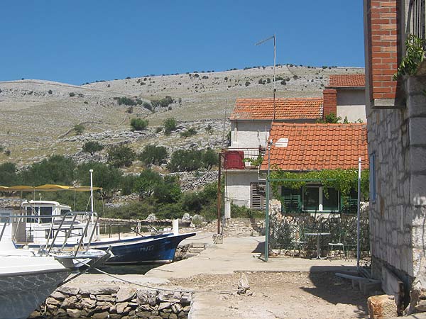
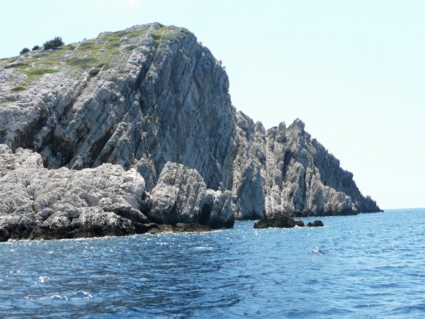
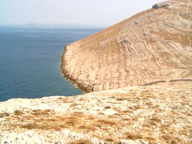
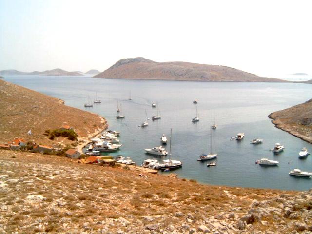
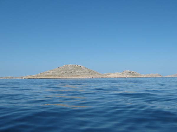
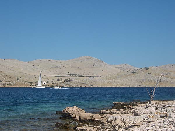
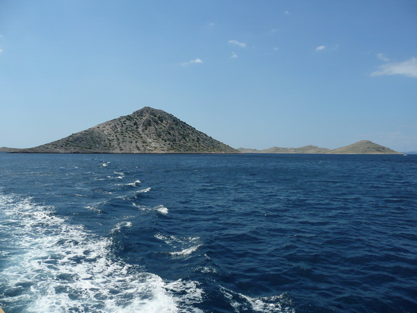
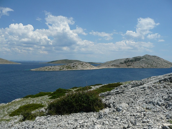
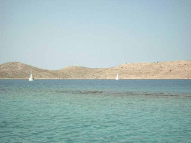
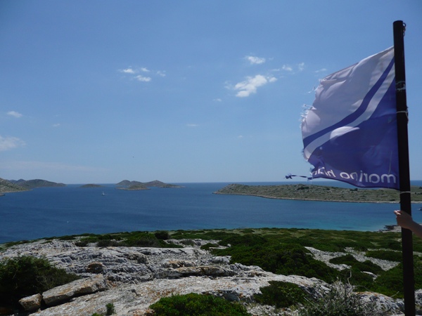
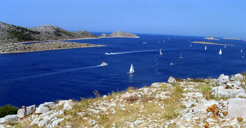
video Kornati
National Park Kornati - Croatia
Kornati National Park
Kornati National Park Map
Getting there - Krka National Park
In the resorts numerous travel agencies offer an organized trip to the National Park. All visitors of the National Park must pay a fee of 30 kuna. In low season the price is reduced to 20 kuna. Due to the many checks a ticket in any case is necessary. Organized day-trips cost about 210 kuna. These day trips usually crossing, menu and shore excursions with bathing facilities. These trips can be booked in the following places: Dugi Otok, Murter, Veli Iz, Ugljan, [[Island of Pasman | Pasman] (Vodice) and from Zadar and Biograd. The island passage between the islands of Kornat and Smokvica is called official National Park entrance. The Kornati National Park is car free.
In the central administration of the national park in Murter on Murter island and on the island Zut can purchase tickets for the Kornati National Park.
On the islands there is also a tourist office. It is located on the island Ravni Žakan.
-
National Park Krka
National Park Krka
With 72 kilometers, the Krka is the longest river zentraldalmatische and thanks to the 20 km between Knin and Skradin, which occupies the Krka National Park, probably the most spectacular in Europe. Countless caused by geomorphological processes rapids, trails, pools, waterfalls and other karst and Tuffphänomene shape the course of the river and offer at each point a new and exciting perspective on the ingenuity of nature.
Beyond the National Park limits flows the Krka into the lake Prokljansko which reaches to Sibenik and then finally flows into the Adriatic Sea.
 Nationalpark Krka
The management of the park has scientific, cultural, educational and visual "tasks taken up the cause, but the park also sees as a recreation area, so that not only the flora and fauna thrives here but also people flourish.
In order to preserve the current status and the beauty of natural phenomena as long as possible, it is necessary that all visitors abide by certain rules and environmental protection represented engaged. So is naturally expected that no one leaves the marked paths, its packaging and other waste disposed of properly (not only because of lying in the undergrowth since the war land mines) and of course not poaching, animals or otherwise interfere with or damage plants.Also open fires are prohibited and those who want to film for commercial purposes should take care in advance at the park headquarters to a filming permit. In the park, two different itineraries offer. On the two park entrances Skradin and Lozovac you can (depending on the season) to purchase a ticket to the park, and the ethnographic museum for each 30-95 Kuna, said from Skradin a half-hour boat ride, in Lozovac a rail shuttle service are included.
Who are driven for four hours over the largest lake in the park and would like to visit the monastery island, should allow an additional 100 kuna per person - however, children often get discounts.
Information about the National Park Krka
National Park History Krka
The many small villages in and around the national park around and the former mill show that the Krka and its banks indeed have always attracted people in its spell, the protection and preservation of nature but is a relatively new idea. In 1948, the river course between the Bilusic was baked and the Skradinski Buk first time as a "rare natural resource" and "significant landscape area" classified. Thus the first step to establish a future national park was done.
First, the protected area was up to Krcic extended beyond the Krka source and Sibenik Bridge behind Skardin so that in some books, the establishment of th
 e national park is dated to the year 1955th And although there were energetic initiatives to preserve this landscape even then, the status of the park was not established. With new industrial opportunities also changed the view of the river. It has been considered to build hydroelectric power plants on the banks of the rapids above the falls. Compromise Ready was between the economic benefits and the responsibility towards nature - and of course the prestige and tourism, to bring a national park with it ... - weighed and the area ultimately limits: The hydroelectric power plant Miljacka II is high in the vicinity of the source, directly behind him begins the reserve.
So then lay five waterfalls outside the park area and many visitors also saw the most beautiful of all canyons there. In 1985, the area around the two most impressive lakes and waterfalls, two-thirds of the total flow course and the surrounding slopes, cliffs and forests was declared a national park. Then in 1997, the park received with 110 square kilometers of the northeastern boundary of the Krka estuary of Butišnica to Skradin Bridge in the southwest its present form, with only 9 square kilometers of which are covered with water. The hydroelectric power plant is still in the park and in operation, but needs conservation rules operate compliant. One of the conditions for the establishment of a national park is one that a larger area has exceptional natural phenomena, these are original and largely unaffected by man emerged and have continued and there have several natural phenomena appear in this space. With its characteristic river course, the species richness in flora and fauna as well as the rugged yet elegant rock structure of the Krka National Park meets these criteria play - it also thousands of visitors per year and a power plant will not change!
Attractions

The waterfalls are the trademark and the main attraction of the National Park Krka. Overall, 17 rows barriers, dozens of smaller and a handful of big waterfalls together, overcome together along the entire length of the parking area 46 meters. On his journey through the plateau, the Krka extends even to a width of about 100 meters, then milled again fjord-like ravines into the porous stone. While the water outside the park often looks gray and gloomy, it flows here - enriched by minerals - in iridescent green on the Travertinbrücken. A good view of the water masses have been above the bridge and the wooden pier below the main cases. Here one stands head before rushing wet and further down you have the opportunity to dive with the whole body into the water - here the swimming holes, the torrent has however long since turned into a calm lake. Below particularly interesting and famous waterfalls, monuments, lakes and Krka formations are described.
Butišnica Estuary
Often we read that the Natinalpark Krka there has its limit where the Butišnica leads into Krka. In fact, it behaves exactly around different: the mouth of the Butišnica artificially 1.5 km eastwards relocated to the place Knin to protect against possible floods. Definitely start here, four kilometers away from the source of the Krka, the nature reserve and you can already see on arrival, the picturesque green slopes that hold times as valley, sometimes a gorge the river in its path. If you have a lot of time, you can visit the castle Knin near, but most are from the first impressions of the park so fascinated that they want to see as soon as possible even more of nature!
Bilusic Buk
The first waterfall is located 12 kilometers away from the source. Here the water falls on two levels close to 20 meters in depth after the top line was artificially lowered in order to prevent congestion in the vicinity of the town of Knin. This in turn meant that the water of a lake flowed and remembers only a slight broadening of the river just before Bilusic Buk at him.
Brljansko jezero
In the 1300 x 400-meter lake Brljansko the water takes on a deceptive calm before it falls down the same, 15m high waterfall. On the banks of pines and oaks and lindens grow representing a successful contrast to the bottle glass colored water with its lush greenery. The lucky ones may find the scrub otters and badgers!
Manojlovac
The highest Kaskardenformation includes at the same time one of the highest waterfalls. Up to 32 meters in height measure the levels, overcome the total of nearly 60 meters. Here flow several small water arms and branches together to form a large waterfall and observers are always entranced how to few meters from the romantic and gentle rippling gurgle a roaring waterfall is. Below the falls there is a 200 meter deep gorge that you can photograph the most spectacular of the intersection just above the Manojlovac Falls.
Rošnjak
Just one kilometer behind Manojlovac is the waterfall Rošnjak which differs from all the others of the park: here not the typical paths, pools and steps have been formed but the water falls by a gaggle rule edge unimpeded into the depths, then flows further on himself level. Although the waterfall is 8.4 meters high, it is very spectacular by the steep mountain walls surrounding it.
Miljacka
This step structure measures 23.8 meters in height and is just a few hundred yards behind Rošnjak. The gorge here is gradually changing into a valley, the once near-vertical walls flatten and make this cascade easily accessible. For this reason, here in 1906 one of the first hydroelectric power stations in Europe was built. The enormous size of the Krafwerks it can be estimated that in him permanently the amount of water is needed, which flows within half a year by the Krka it.
Krka monastery
The Manastir Krka, which actually bears the name Sveti Arhandel was first mentioned in 1402. Back then gave Jelena Subic, the sister of Emperor Dusan, named after an archangel building Orthodox monks. Since then, it overlooks the Krka on the valley Arandelovac and further emphasized the already peaceful and contemplative atmosphere of this place. The numerous and complicated reconstruction measures, however, were not completed until the late 18th century, so that established a headstrong style mix of Byzantine and Mediterranean elements in the walls. Opposite the monastery on the east side of the river Krka are the last remnants of medieval castles, three kilometers away is the village Kristanje - but otherwise directs round none of the meditative contemplation and the beauty of nature from.
Arandelovac
Two kilometers behind Miljacka when the rushing and gushing Krka calmed down, there is an idyllic green valley. Special gem of this region is the Monastery Manastir Krka, which was built here between the 14th and 18th centuries. Because of the high proportion of marl in the soil occurs at this point especially much fresh water into the ground, and a sub-Mediterranean flora thrives under the almost perpetual sun. That this is a particularly peaceful and livable place here already found families Bogetic and Martinušić, who built their castles here in the 14th century of which unfortunately only ruins remain today.
Roska
The barrier at the end of the six-kilometer long lake calm the course of Krka so much that it almost looks like a stagnant here. The just so open valley landscape narrows here with rugged, gray rocks, at the 150m high walls at best Adler can feel comfortable. Far from above hikers curious and cautious about the cliffs from below looking boat trippers on the vertical rock formations rising. Then suddenly swing comes back into the watercourse and Roski joins with its myriad small steps, islands, barriers and cases. About 27 meters of altitude, the Krka widens here of a narrow canyon on a 450m wide lake.
Roski
At Roski the Krka flows through between steep cliffs pass over sharp rocks and rough rocks. As in a natural Stause the hineinpreschende here water is caught, tossed, thrown back and dismissed in peace after many escapades at the other end of the course again. Previously formed over a length of 600 meters, rapids and small waterfalls that make nature appear ald creative, tasty essence. Everywhere sparkles and thunders the water, it foams and hisses, swirls and virtually seem to dance. On the banks dense green growing on gray rock, the water can be seen in the particularly flat spots shine through the reddish marl, who heads the groundwater here in the riverbed. Overall, one counts on Roski 12 Kaskarden that - it maintains at least the vernacular - are by no means a natural origin. In fact, the red rocks underwater namely tile roofs, the gray thresholds walls should be, and the whole reason of Roski slap the legendary sunken city Roski themselves who may well have perhaps been here in legendary time on dry ground, but in any case at extremely awkward place would have been built.
Medu Gredama
Behind the Roski slap the banks of the Krka constrict back to a ravine - the Medu gredama. This scenery covers about 500 meters, the canyon between 50 and 100 meters wide, and the rock walls are up to 15 meters high. The structure of the layered rock layers here is unique: a cave with three openings per Suplja offers an incomparable view of the landscape. Subheadings and to the upper end of the plateau can be reached best by foot from Brištane, but also by boat from the sight of this Krka section is impressive and worth seeing. Those who book a cruise on the adjoining gorge Visovačko jezero, is usually also brought here.
Visovačko jezero
The largest lake in the National Park measured up to a kilometer in width and is framed by two waterfalls. The bank structure is characterized by gentle, little steep slopes in the upper part. Here, several communities have settled, forming a rural community under the name Miljevci. Three kilometers from the gorge Medu gredama is the interesting monastery island Vesovac that one of the main attractions of the National Park. On the opposite banks overgrown ancient stone and downy oak. Another 6 kilometers downriver, the spectacular travertine waterfall Skardinski includes baked on.
Visovac
In the northern part of the 12km Lake Visovačko jezero the one hectare, partly artificially reclaimed island Visovac is the Franciscan monastery from the year 1445 on it. Originally lived here in the 14th century Augustinian monks in a small, rustic monastery. But when the threat of the Turkish army in 1440 was too big, they fled. Only five years later took over Bosnian Franciscans the island and built their own monastery. From here the monks had a beautiful view of vineyards and olive groves, they hardly could enjoy, they were committed to the study of philosophical writings. These books - including the Aesop's Fables in a version of 1487, early Croatian fonts and handwritten manuscripts are still kept and exhibited in the library. Also here is also added in the 16th century church that the refugees offered protection and hope at the time of the Turkish invasion. Today only eight monks live on the island. How meditate their coreligionists past centuries and study them in the seclusion of the island - but also enjoy regular contact with the outside world in the form of interest and tactful visitors. At the island is best reached by one of the excursion boats that leave daily at 10:30, 12:30 and 14:30 to the four-hour sightseeing tour of the lake. At least, visitors have ample opportunity to take in the landscape beyond the island to yourself! However, if you just want to make a special visit to the old walls and gladly dispenses with the itinerary, the attention of the monks on the banks can attract a standing with shouting and waving. If you will notice, you will be picked up and ferried from one of the brothers.
Cikola
When Skardinski buk another creek in the Krka enters - the Cikola. this flow also is here dammed on the width and tranquility of a lake, so that the last three kilometers of its original riverbed darliegen today flooded and you can hardly recognize it as the river. Rather it looks when viewed from above as if you are standing here in front of a single, boomerangförmigen lake. Following the Cikola upriver one can find equally beautiful and almost as impressive natural formations such as at the Krka. In the source area there is even a circular, 150m wide lake that Torak, in the depth of 30 meters the water arises from a karstic well.
Skradinski Buk
The most beautiful travertine waterfalls in Europe is between the small town of Skradin and Lozovac and is repeatedly approached daily by boatloads of parking management. For good reason: The 800 m long 17-Stepped rock formation, on the flowing water here is not only pleasing to the eye but the legend also home to elves, goblins and water spirits. This formed and changed their home in earlier times as it sees fit, now pushes to the convertible-like structure of the Skradinski Buk rather the seasons and the erosion. When the snow melts here thundering up to 300 cubic meters per second on the karst ground and the rocks, and even in the summer when the this opening into the Krka Cikola is dry, there are still on average 50. This imposing, daunting and yet romantic waterfall not only serves as a backdrop for many holiday pictures and picture postcard but delighted bathers and beach visitors who indulge on the banks of the pleasure of times to see while swimming anything but endless horizons or small islands.
freshwater limit
At the foot of Skardinski Buk waterfall, the water masses from the source of the Krka and across from the Adriatic mouth geschwemmte seawater flow together. At low water levels this occurs directly under the waterfall, in the spring when the melt water raises the level, only a few kilometers further down the river. Here, the water do not mix around, but the lighter and less dense fresh water forms an upper layer of first 2-7 meters, including purges the seawater in the opposite direction. However, the fresh water layer decreases the further course of the Krka and flows in the mouth area almost exclusively saltwater in the Adriatic Sea.
Skradin
In the picturesque town, the most is the starting point for exploring the Krka National Park, remembered today not much in the turbulent history: Already the Illyrians knew from a small town to report to the large waterfalls, the town Scardona. They tell of wealthy fishermen and wealthy merchants. These reports might Slavs made and attracted envious of their migration, definitely the place was soon destroyed. Only the early Croatian kings, who built here in the unique landscape their Pfalz, could bloom again the area. 1522 Skradin was conquered by the Turks, soon fought over by the Venetians and strategically expanded and was until 1830 even bishopric. Today, the site sets as recreation and excursion city is Who has a little time should calmly look at the city -. Because while around the fruit market and the Marina quite lively bustle - tourist boat tickets or return of the excursions, restaurant owners are trying to loud cries guests to win for their specialties, on the beach promenade to stroll along in the splendor of yachts and off - the back streets of the village often deserted. Nested and confusing they writhe in shadow rough houses with the characteristic red roofs, the lush green hill. Here live the 700 inhabitants and it focuses on the holiday homes of wealthy Sibenik and a parish church from the 17th century is also seen.
More Attractions
Ethnographic Museum
A former mill on the upper cataract is now the ethnographic museum of the national park. Here you can learn how the inhabitants of the surrounding villages and farms have lived and mismanaged in the past. Well worth a visit not only because the park entrance also equal the fee for the museum card to pay for another: Here you will find next to the regular milling operation also a clever 'eco-washing machine ": The river water spills into a round stone basin, is whirled through nachdrückende water masses and again pressed out which hung in baskets in the basin wash cleans almost by itself! Outside agricultural equipment available where you can see that the daily work with the laundry by no means came to an end and on narrow paths and wooden planks stairs it goes uphill to the best views of the park. Anyone who feels fit enough should take this little walk and just remember his camera! The museum is daily during the season 8:00 a.m. to 22:00 open.
forts
In the Middle Ages the region was dominated by the River Krka from feuding and warring noble families. While the rural population tended their goats, the vineyards ordered and produced oil built the noble houses and imposing military age castles whose ruins can still be seen today along the river course. Downstream you can still see outside the park, the castle Knin, the National Park follow Tronsenj, Bogočin and Neceven, a little further south and Bogočin Vilingrad. Of all these former magnificent the ground are still preserved and they all share the same fate: Built in the 14th century, eventually conquered by a mighty Croatian family, collected in 1522 by the Turkish army to the Ottomans had to withdraw 1686th Only the further located towards the Adriatic fortresses Kamicak where the famous Cardinal and guardian of a king Juraj Utjesinovic was born in 1482, is older: Dating back to the 13th century. And Kljucica that battle castle built in 1330 near Skardin is still the best preserved of all the forts today. But when the time destroyed the stone and has the chambers taken their roofs are the castles always still indicator and address for one thing: the best view over the Krka Valley. They are always at the highest points with stunning panoramic views and had to be held during this earlier by hostile troops out you can today to see just enjoy!
Flora
Before the Krka Park was declared a nature reserve, lived a mostly Peasant society in its environment. Goats would graze and houses had to be built so that the formerly dense forest was gradually largely deforested and reforested only in recent years at the lower Krka course again. Thus, the flora of the park is indeed represent no more than the authentic, they would be if the area would actually untouched by man, but more varied a lot more interesting.
After the disappearance of the trees made room for numerous smaller plants in the shade of the tree tops hardly would be able to spread. So today offers a jungle thicket exemplary, which corresponds to 60% of Mediterranean flora as well as to 20% influences from the southern fauna exhibits.
 Nationalpark Krka - Flora
The other 20% of the trees, shrubs and perennials proliferating are widespread and not just specific to find in a region. In total 860 known plant species have already been documented.
This species richness is primarily made possible by the large water surfaces of lakes that store the heat of the summer and well into the winter months in, and so provide a mild klime, also soak the soil in the drought enough freshwater. Just at the south end of the lake grows a healthy marsh vegetation, especially beautiful is reflected in generous lilies areas and reed banks.
particularly widespread
trees:- Steineiche
- Mastix-Strauch
- Steinlinde
- Manna-Esche
- Dreilappiger Ahorn
- Flaumeiche
- Aleppokiefer
- Schwarzkiefer
- Ilex
- Mastic
- Privet
- Manna ash
- Trilobal maple
- Flaumeiche
- Aleppo pine
- Black pine
Marsh plants:
- Black Kopfired
- Head rush
- Juncus Subnodulosus
- White water lily
- Dough
Fauna
Who after cuddly, furry little animals as in a Disney forest lookout in Krka Park, missed the most interesting part: mammals are here not particularly common, but can be 220 species of birds, discover 18 different fish and countless amphibians. buzz in the air, on the ground, at sea and on the plants, fly, crawl, hop, climb, swim and live anywhere the original copies and the final inventory of biologists is still not in view. So far we know, after all, that one of the four salmon family lives only here in the Krka, total estimates to the freshwater fish species up to 12, which the Krka occupies a leading position in European comparison. Especially in spring and autumn the cliffs and the trees of the park are animated brisk. Migratory birds can be here on their journey between the hemispheres down, rare eagles can be seen here in the looting or the construction of its Horst.
When the sun goes met a bright chirping the air - the bats are active and set out to hunt for all de insects, which are the next day sting no more visitors. Even otherwise you have nothing to fear from the wildlife around the Krka: While it is possible that a snake crosses the trail, but they are harmless to humans and predators like badgers and jackals have far more palatable on the menu are a humanoid. So the fauna of the National Park Krka for biologists is a phenomenon and a popular research area, for regular visitors but only a feast for the eyes - and where they can take their eyes off the other natural beauties ever!
Particularly Widespread
Fish:
- Salmo marmoratus
- Hazel
- Rudd
- Bitterling
- Chub
Amphibians:
- Teichmolch
- Common toad
- Edible frog
- Toad
- Grottenolm
Reptiles:
- Armored Creep
- Smaragdeidechse
- Tortoise
- Slices finger
- Terrapin
Snakes:
- Four lined snake
- Leopard snake
- Montpellier snake
- Horned viper
Birds:
- Heron
- Wild geese
- Wild ducks
- Snipes
- Coot
- Field warbler
- Swallows
- Sailor
mammals:
- Jackal
- Steinmarder
- Badger
Rare animals:
- Steinadler
- Schlangenadler
- Falken
- Eulen
- Otter
- Fledermäuse (18 Arten)
- Golden eagle
- Short-toed eagle
- Hawks
- Owls
- Otter
- Bats (18 species)
National Park Krka - Geo
In addition to regular tourists mostly keep some geomorphologists in Krka National Park. However, these can not fully enjoy the view and the beauty of nature, given them the Krka but some headaches. It is still not clear why it is precisely here came to just those processes that show up on their thousands of years of formation as we see it today and appreciate. Although the evidence gathered so far outline an interesting picture, but completely is to the Rästel to the Krka Park might never be able to solve.
Karst
It is known that in Dalmatia prevails the Karst. Through this porous bottom of the river is in its
entire course of not only fed by rain and spring water but also by the liquid from inside the Earth.Krka National Park Croatia 4These water contact for Vrschein if them in the otherwise permeable groun
 d suddenly a layer marl "in the way". They carry minerals and particles into the river bed, which in turn are deposited on small plants and jams, which occur throughout the centuries basin walls and barriers of tufa and travertine.
The water flows now through thes
e barriers, it appears, according to their height than rapids or a waterfall. the barrier grows to such an extent that the flow is not enough water masses are to flood at the top comb, it becomes a lake. The erosion forces of the water and the sediments act today permanently contrary, so that overall a fairly stable landscape has emerged that - remain so in the coming centuries yet so obtained - provided that all park visitors observe environmental protection measures and the global climate is not changing dramatically will.Erosion
And today it seems difficult to see how in a region that is famous for its summer drought, could make up to 200m deep lakes and gorges. Nowadays, the water content in Krka Park is indeed regulated by locks and so maintained throughout the year fairly constant, but this technique was of course only after the area was fully formed. One assumes that could emerge the structure towards the end of the last ice age, because the slopes were without vegetation and thus more prone to erosion time. As then conditionally grew by good sunny climate and the mineral kingdom freshwater first algae and mosses, this strengthened also the soil and riverbed stabilized. On the slopes also sprouted more and more varied plants, so that the Krka also could not widen easily. Although in some places created but about 100m wide, relatively flat river routes but the majority of the course form a readily identifiable stone structures that provide the Krka only upward room for expansion, which in turn explains the impressive depth.
Mouth
A special feature of the Krka is the high CaCO2 content of the water. This is thanks to them that the river does not seep into the loose tuff basic but flows to the sea. Incidentally, the mineral content of the river also changes dramatically elsewhere in its course: While natural freshwater from the soil occurs at the source near Knin, the Krka is already filled kilometers off the Adriatic mouth with salt water. This is due to erosions just described above, which have the riverbed in the lake near Sibenik far below seabed level can decrease while the sea level about 10,000 years ago increased dramatically so that the salty sea water is flushed in and mixes with the river water. In this sense, one could actually speak of the 20km of the mouth of the Krka as narrow bay of the Mediterranean. Others consider the Krka less from scientific viewpoints but simply appreciate its beauty and call it an "oasis in Croatia summer heat" - which is now geologically and biologically wrong, but even if we do not know exactly how it came to be also all geomorphologists and hydrologists agree that we are dealing with a "paradisiacal landscape"!
National Park Krka - Images


National Park Krka - Video
Approach to the National park of Krka
The lying in North Dalmatia Krka National Park with its waterfalls to reach Sibenik on the road to Drnis driving. After about 10 km you have to leave the road to Skradin north, then to go to Lozovac or even about 8 km to Skradin. Who wants to Roski Waterfall, must continue to Drnis. There, the road branches off to the Roski waterfall.
Who wants to go with his boat to the National Park, this can over the river Krka to Skradin, only because the entrance to the National Park waters is not allowed.
Entrances of the National Park Krka
Input 1: Skradin - Directly in front of the place Skradin is a parking lot and the departure point of the taxi boats. The taxi boats bring in the season, between 10:00 and 18:00 and visitors free to the entrance below the Skradinski buk. Tickets can be bought previously on the harbor promenade in the tourist office or later at the entrance to the national park. On the way to the entrance one passes the Skradinbrücke. Alternatively heading north of the canyon is a lovely walk to the national park entrance.
Input 2: Lozovac - With his vehicle to reach a parking lot above the Skradinski buk in Lozovac. A bus takes visitors on a narrow dead-end street with several bends to top National Park entrance. From the terminus Buszubringers several pedestrian routes lead past the waterfall stages.
Input 3: Roski slap - this situated on the eponymous waterfall entrance can be reached by car via Siritovci. He recommended that those visitors who wish to explore the National Park by boat ride above the Roski Slap, which on a day visit to the Skradinski buk time hardly feasible.Krka National Park - Map
-
National Park Mljet
National Park Mljet
In the northwest of the island of Mljet is a very beautiful National Park. Founded the National Park Mljet on 11.11.1960 and has been one of the main attractions of the Emerald Isle as Mljet is also called. The special thing about this area, in addition to the age-old pine and oak forests, the whole over centuries beauty of nature. Here you will find the channel Soine, the Big and Small Lake as well as some significant cultural and historical monuments such as palaces and basilicas. Especially nice is the small island of St. Mary with the Benedictine monastery.
The Mljet National Park is about 20 km north of Sobra, where the port of the island. Advised to go there by car or scooter. The ride is quite simple, since there is only one road and the park is signposted early. Entrance to the National Park is 90 kuna per person, equivalent to just over 12 €. At the entrance to the park is a large unspoilt free parking. There are picnic tables and benches, a large map of the park and a small house, where you can buy the tickets.

From here one goes on just a few minutes walk and then you have come to the pier, from where the ships of the park to the island of St. Mary. Ships sail from the early morning on a regular basis over the Great Lake to the island and back. It takes only a few minutes, even from a distance you can see the church and the Benedictine monastery. Once on the island can you go in a small souvenir shop or directly next to the monastery and the church. Currently they are in renovation work and therefore can not be visited. If you follow the road further you come to a little stone chapel where you can find many personal intercessions and prayers in all possible languages. The path then leads to a small very clear lake where you can observe many fish. Much more there are on the island can not be seen.
From here you can take a further vessel back into the National Park. Here you pass on a rental of bicycles, canoes and other small boats. If one continues to get the little lake, a salt water lake is like the Great Lake. Both lakes are connected to the sea and they are healing effects spoken to. There is a small beach where you should definitely take a swimming break. The water of the lakes in the park is average 2-3 degrees warmer than in the other beaches on Mljet, the Great Lake is in summer about 25 ° warm and the Small Lake as much as 27 °. Here swimming is really fun. Mostly here is an ice cream van, which also sells soft drinks to find. Who does not want so close to each other at the visitors can go into the water and across the street from the beach. Here you can sit in the trees and is only steps from pristine warm lake. If you have enough swum and lying in the sun, you can explore the National Park on the very well-developed hiking trails and enjoy a lot of nature. Even in high season you can enjoy and unwind the natural rest, because you are traveling alone on many parts of the path. A visit to the National Park is very worthwhile and you should definitely pack swimsuits because swimming is a real treat here.
Information about the National Park Mljet
- History
- Flora und Fauna
- Geology
- Photos
- Video
- Map
- How arrive
History National Park Mljet
The western part of the island of Mljet was declared in 1960 a national park to protect the Aleppokiefern- which oak and holm oak woods and the two saltwater lakes. These salt lakes formed approximately 10,000 years ago when formerly known karst fields filled by the last ice age to the rise of the water level with water. At the time of establishment of the national park had the connecting channel between the sea and the lakes a width of about 4 m and was only half a meter deep. Later it was the channel made navigable water - widened and brought to a depth of about 2.50 m.
On the peak of Mali Gradac (close to Babine Kuce) are the remains of an Illyrian fortification. In Roman times, the island is mentioned under the name of Melita. From this period finds are present all over the island: in Pomena, Zare, Pinjevica. From the transition period to the early Middle Ages the ruins of a palace and a early Christian basilica in Polace originate. Around 536-537 the island became part of the Eastern Roman Empire. Later, she fell to the tribe of Neretljani, then to the principality Zahumlje. From this time, the pre-Romanesque churches of St. Pancras, St. Andrew and St. Michael in Babino Polje submitted. Grand prefect of Zahumlje, Desa, gives 1151 the entire island to the Benedictines (from the abbey Pulsano at Monte Gargano in Apulia) that build their abbey and church on the islet in Big Lake. In 1333 Mljet goes through a donation The Bosnian viceroy Stephen to the Republic of Dubrovnik. From this time, the island is owned by a duke who resided in Babino Polje. In 1345 Mljet gets its own constitution. In the Gothic several churches (the parish church in Babino Polje, the Holy Trinity Church in Prozura, St. Vitus in Korita all _ 15C.) Were built on the island. The ruined church of St. Mary of Mount dates from the transition period between the Gothic and Renaissance. The profane architecture is represented with some characteristic buildings (the Renaissance castle of Mljet princes in Babino Polje, several Baroque houses from the 17-18. Century. In Korita).

Mljet National Park (since 1960), situated in the northwestern part of the island; 54 km2. The park includes the Great and the Small Lake and the Soline channel. The lakes are connected by narrow and shallow, artificially deepened channels both mutually and with the sea. The National Park is home to a large number of plant communities:
Aleppo pines (Pinus halepensis) and holm oak (Quercus ilex) with dense scrub. The Big and Small Lake and the Soline channel have special physical properties: for example, the Small Lake is exposed to a natural eutrophication process, so that in the lower depths of no oxygen is present. In the woods mongooses live; the south coast is the habitat of the monk seal. In the south bay of the Great Lake, a 200 meters is long and about 120 m wide island on which the Benedictines built in the 12th century. A monastery with St. Mary's Church. The Church of St. Mary has Romanesque features. The vestibule with high reliefs (saints) was probably built at the turn of the 12th into the 13th century. Preceded by a Renaissance portico with the coat of arms of the Gundulic from 16-17. Century. From this period dates also the quadrangular tower. On the northeast side of the church there is a Romanesque bell tower. In the Baroque period the church received two side chapels with altars. The old monastery building with a cloister and a spacious basement was enlarged in the 16th century. To the sea side to a two-storey Renaissance building with a 30 m long terrace at the front side. At that time the monastery was fortified (defensive walls and towers at the south end). The monastery was secularized in 1869 and abandoned; it was until 1941, the Forestry Administration of the island of Mljet; 1959_60 hotel was made of it. In recent times the church of their sacred function is returned; for the monastery is still looking for a purpose. The feast day of the church is Assumption (August 15). In the Benedictine convent of Mljet dwelt as monks known writers from Dubrovnik: Mavro Vetranovic (1482_1576), Mavro Orbini (died 1614th) and Ignjat Durdevic (1675_1737), who described his stay on Mljet in a poem.
Flora And Fauna
The island of Mljet owes the mild Mediterranean climate and the quiet location foreclosed their wealth of vegetation and many different species of animals.
In the plant world of Mljet the pines and oaks are most strongly represented numerically. A huge pine forest that covers the small and the great sea, the Pomena bay, mountains and Gaja Bugari and the village Govedari one of the finest, healthiest and densest of its kind in the Mediterranean. The evergreen oaks are found primarily in Valakija, Nikolin Dolac, Neze and Ivanje Polje. Before devastating forest fire in the early 20th century, could fro towards -and even in midsummer at noon in the shade of centuries-old pine and oak trees between the towns of Babino Polje and Govedari. The entire street was shaded by the tall tree crowns and through the dense foliage blanket came no ray of sunlight through. The southeastern part of the island of Mljet is a nature reserve, national park Mljet find other rare plant species that are considered particularly worthy of protection. Therefore, in the national park are strict rules. For example, the following rules should follow there: you must not pick flowers, leaves break from the trees or leave the marked paths.

While the forests formerly played an important economic role in the life of the islanders on Mljet they now serve primarily scientific and tourist activities. The management of the National Park of Mljet and the forest administrations of towns Split and Dubrovnik are taking important steps to protect forests. The fauna of the island of Mljet is quite varied among many sea dwellers such as perch, bream, conger, moray eels and countless other you meet on land, for example, on martens, wild cats, wild goats and donkeys, dormice, soft-shelled turtles, mice, insects and many birds. Today, there are on the island of Mljet some non-toxic species of snakes. Early last century many islanders died from the bites of poisonous horned viper, so that the then forest managers Indian mongoose to Mljet took that ate the poisonous snakes. Today, thanks to the mongoose, the number of poisonous snakes minimized so that they are no longer explicitly mentioned. The small gray animals come with her tail to a length of about one meter. The tiny head with the small alert eyes and a pointed snout is framed by barely visible ears. Despite their comical appearance are the mongooses industrious hunters and will eat anything which is not larger than a rabbit. Even birds are not safe from them, particularly in chickens they are targeting. Since Mungo also poisonous scorpions are eaten among the inhabitants of the island of Mljet very popular. Because the mongoose between six and nine boy getting growing every year their numbers continuously.
In addition to the mongooses are also 1958 red deer, Axis, hare species of chamois mouflon, pheasant, partridge and wild boar on the island of Mljet has been exposed. To date, there have them only the hare, red deer and wild boar managed to survive. The wild boar but evolve gradually into a real plague, since they are not only very voracious and some species have almost eradicated, but also orchards, vineyards and potato fields lay waste to their foraging. To regulate this imbalance has to the island of Mljet boar hunts that take place under the supervision of the hunting association and the management of the national park.
Geology
The National Park occupies the northwestern part of the island of Mljet and consists almost entirely of forests. Its total area is 5375 hectares. From Mount Montokuc and other summits there is a wonderful view over the National Park and to the peninsula Pelješac and the open southern Adriatic. In National Park Mljet is two natural salt lakes, the Veliko jezero and Jezero Mali.
Veliko and Malo jezero
These salt lakes are a unique geological and oceanic phenomenon of worldwide importance.

The approximately 145 hectares and in some places 46 m deep saltwater lake Veliko Jezero has at Soline a natural channel connecting the Adriatic Sea and a flow to smaller salt lake Malo jezero (24 ha). Around the lakes runs a footpath which runs past the hamlets Babino, Kuce, Pristaniste and Soline. In Veliko jezero is the monastery island Sveta Marija. These torrential ford is designated Veliki Most and offers the best swimming.
Monastery island Sveta Marija
On the monastery island Sveta Marija is the former Benedictine monastery from the 12th century. In the 16th century. The church was extended in the renaissance style and used in the period before the Yugoslav war conflict as a hotel.Per Tourboat can translate every hour to the Benedictine Church. Who trusts himself, can also swim across.
Pomena
Very sexy is Pomena in the northwest on the island of Mljet. Footpaths connect this fishing village with the salt lake Malo Jezero. In Pomena's only hotel located on the island.Polace
"Polace" means Palace and is due to the former Roman settlement on the south end of town here. Polace has a small harbor, are offered from which trips to Peljesac peninsula.Photo


Video
Map
Getting there
You reach the island of Mljet coming by ferry from Dubrovnik or Korcula. The Hauptfährort is Sobra. At 10 and 18 o'clock ferries from Dubrovnik and from Sobra at 6 and 19:30. 2x weekly ferry from Rijeka to Dubrovnik passes.
From the ferry terminal on the north side of the island of Mljet you have on the island continue to the National Park. On the island 3x drives the island bus from Sobra to Pomena and back daily.
1x daily is the car ferry to the island of Korcula on the road (13 pm from Korcula).
Who wants to translate by car should take the car ferry in Polace, the morning and afternoon runs between Polace and Trstenik on the Peljesac peninsula.
The park administration of the national park is located in Pristanice. 2
Visitors can enter the Park only through official entrances, these are: Crna Klada, Pomena and Polače.
The places Pomena and Polače are connected to the sea by a system of forest roads.
Visitors who arrive under an organized day trip must reside during their stay in this group, while individual visitors can move around in the park, where they want - as long as they abide by the parking regulations.The National Park Mljet offers a wonderful sight throughout the year. The trails along the shores of the famous lakes make your stay very pleasant. The hiking and biking trails are in the area of the park consistently in the shade of large trees, so it is not too hot in the summer to make a trekking tour. The outlook from Montokuc and other peaks are lovely, overlooks the entire National Park and the open sea at the south Adriatic.
Already starting with inputs marked trails for Great Lake, the Small Lake and of course to the island of St. Mary. So it's easy to explore the park on your own. But you can also ask for some money a guide to lead you through the park.
- The Great Lake and the Small Lake are the salt lakes representing a unique geological and oceanographic phenomenon of worldwide importance. They originated approximately 10,000 years ago. Until the Christian era they were still filled with freshwater, but then came a narrow passage to the sea, Soline bay, and the lakes salted.
- On the banks of the lakes, there are hiking and biking trails that run in the shadows of the woods.
- You can hike to the Great Lake (it has an area of 145 ha and is maximum 46 m deep).
- A short distance by boat leads to the small island of St. Mary
- There you will visit the ancient Benedictine monastery and a church from the 12th century.
After your trip you can take Miscellaneous:
- You can swim in the lakes almost throughout the year, especially the little lake offers pleasant temperatures from April to October.
- Visit Polace - this is a place with a harbor in a sheltered bay. Guests can visit various cultural and historical monuments as a Roman palace and an ancient Catholic basilica.
- In Pomena you can find everything for a sporting holiday. There are diving and sailing schools or rent bicycles, canoes and surfboards.
Moreover, interesting cultural events, especially in summer:
Mljet cultural summer - it is linked to the Christian holidays Velika Gospa (Our Lady) and Gospe od Jezera (Madonna of the lake). The celebrations begin in mid-July and end on 15 August. On the island of Santa Maria there during this time many concerts and exhibitions in the monastery. The revenue therefrom are used for the restoration of the monastery.
On Mljet and the Half Ironman Triathlon takes place, a traditional annual international competition, which consists of a combination of swimming, cycling and running. It takes place in October and the venue is the entire National Park Mljet.Eat:
Restaurant Melita - within the breathtaking ambience of the island of St. Mary there is a fish restaurant with various specialties of the Dalmatian cuisine.


