National Park Kornati
National Park Kornati
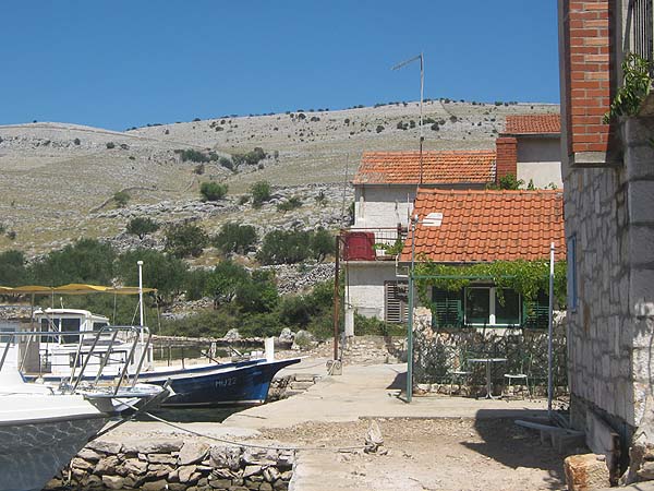
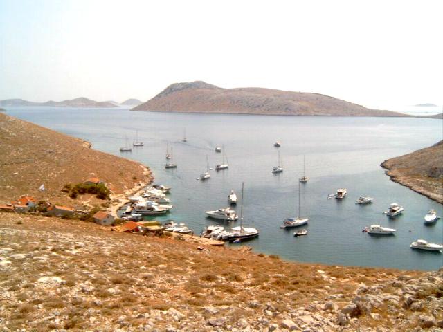
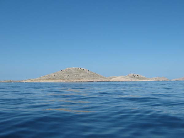
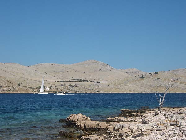
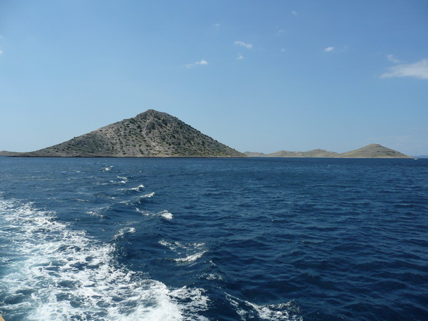
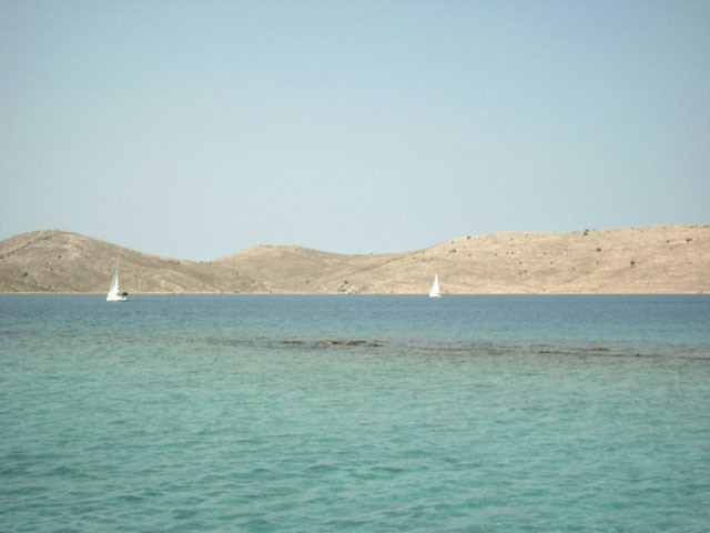
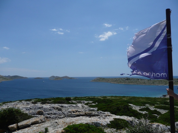
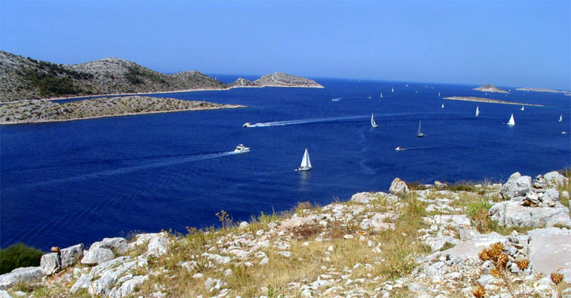
The Kornati National Park (kroat. Nacionalni park Kornati), also known as National Park Kornati, includes part of the archipelago of Kornati (kroat. Kornatski otoci or simply Kornati), an archipelago in the Adriatic.
Kornati Kornati represent the densest archipelago in the Mediterranean and were asked in 1980 as a national park under
strict conservation. The total area of this national park is 220 square kilometers.
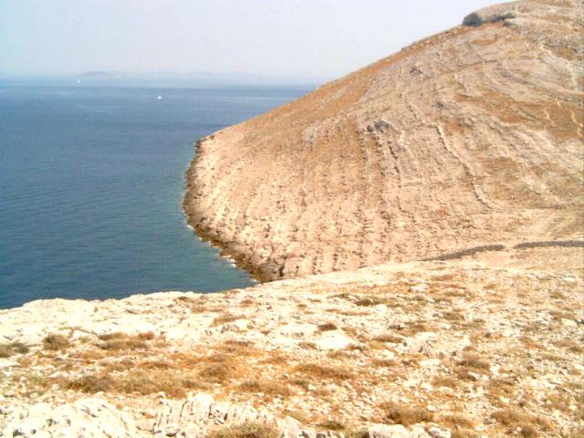
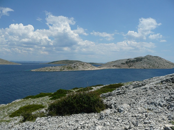
The area is karst landscape. For National Park and the islands surrounding part (undersea) maritime area.
Overall, there is the National Park of 89 islands, islets and roc
ks. The largest is Kornat. The vegetation on the islands is mostly sparse. The islands consist of limestone, are either lit
tle overgrown (scrub) or bare.
There are no water streams o. The National Park Authority is located in the town of Murter on the island of the same name near the archipelago. The inhabitants of the island Murter have always been connected as closely considered with this group of islands, which is why they also incumbent nowadays the administration over the archipelago. For sailors the Kornati Cup is interesting in spring.
Information about the National Park Kornati
- History
- Islands
- Geology
- Images
- Video
- Map
- Getting there
History of the National Park Kornati
Neolithic
Neolithikum
Already during the Neolithic people lived on the Kornati. This is suggested by finds of stone axes in the Zeljkovac field, below the mountain Pedinka on the island of Kornat.
Illyrians and Goths
Illyrer und Goten
The first confirmed colonization of the islands date back to the time of the Illyrians and Goths. This is indicated by small square houses that are individually or in groups (there are remains of example, under the mountain Pedinka, above the Zeljkovac field). Furthermore, there are small settlements (Šćikat, Stražišče, Tureta, Grba) and accumulations that indicate a larger population at that time (these are found on almost all heights on the islands of Kornat and Žut).
The Roman Empire
Das Römische Reich
Even the Roman Empire has left its mark on the islands of Kornati. So can the remains of rustic villas are admired Svrsati in Proversa and fish tanks. Other traces of the Roman Empire are mainly found under water, as the salt plant in Sipnatam or the port facilities in Vela Proversa.
The Byzantine Empire
Das byzantinische Reich
According to many, the rule of the Byzantines or Goths has the most distinctive building, which is located on the Kornati leave,: The Tureta fortress on the island of Kornat. The construction can be attributed to the late antiquity or the early Middle Ages and probably dates from the 6th century, even before the colonization of the Adriatic by the Croats. It is believed that the fortress was built for military purposes, in order to secure the navigation in the then dangerous Adria.
Likewise, an Early Christian basilica is (also from the time of the Byzantine Empire) below the fortress Tureta. Today most of the apse and part of the foundation walls can be visited. Due to the size of the church (30 x 13 m) suspected that during this time a considerable number of residents must have lived on the island.
Situated next to the church are traces of a building. Here, scientists do not agree on whether it is a Templar monastery or a Benedictine monastery.
Migrations
Völkerwanderungen
With the arrival of the Croats in today's Dalmatia, the Roman population was forced to flee from the mainland to the islands. However, this was short-lived, since the sea posed no further obstacle more for Croats. So it happened that the Kornati almost uninhabited remained until the 13th century..
Middle Ages
Mittelalter
From the 13th century. Kornati were resettled. Thus, various constructions can be visited from the Middle Ages. One of these buildings is the church "Gospa od Tarca" (dt. Madonna of Tarac, often referred to as Queen of the Sea) in the Bay of Tarac which was probably built on the remains of an early Christian basilica. An exact dating of this church is not possible, so vary the datings from 12./.13. C., 14th c. Until 15/16. Century. Also of medieval origin of the remains of a salt warehouse, and the submerged in the sea remains a salt production plant (probably late 14th century) in the Bay of Lavsa.
Republic of Venice
The Kornati Islands were particularly in the 16th century. For fishing known. Thus, the Republic of Venice has built on the small island Vela Panitula a fort, which has served mainly to collection of taxes on fishing in the Kornati. Very close to the castle, on the island of Piškera (Jadra) a fishing village was built. The two islands were connected by a bridge. Also a church was built with gothic elements in the fishing village, this was inaugurated in 1560th With the fall of the Venetian Republic the late 18th century. The castle was like leaving the fishing village. So today there are hardly any traces of the village yet, the same is true for the fort. However, the church was restored. You will still visits regularly today.
Islands Kornati
| Nr. | Insel | Fläche | Höhe | Geografische Lage |
|---|---|---|---|---|
| 1. | Kornat | 32.463.820 m² | 237 m | 43° 48′ 6″ N, 15° 20′ 0″ O |
| 2. | Piškera | 2.668.046 m² | 126 m | 43° 46′ 0″ N, 15° 20′ 20″ O |
| 3. | Levrnaka | 1.833.883 m² | 117 m | 43° 49′ 26″ N, 15° 14′ 45″ O |
| 4. | Lavsa | 1.756.113 m² | 111 m | 43° 45′ 0″ N, 15° 22′ 15″ O |
| 5. | Kurba Vela | 1.736.793 m² | 117 m | 43° 41′ 55″ N, 15° 29′ 40″ O |
| 6. | Smokvica Vela | 1.054.430 m² | 94 m | 43° 43′ 40″ N, 15° 28′ 40″ O |
| 7. | Škulj | 881.017 m² | 145 m | 43° 43′ 20″ N, 15° 27′ 20″ O |
| 8. | Silo Velo | 676.758 m² | 63 m | 43° 51′ 10″ N, 15° 13′ 45″ O |
| 9. | Lunga | 617.814 m² | 81 m | 43° 43′ 45″ N, 15° 25′ 15″ O |
| 10. | Mana | 395.627 m² | 77 m | 43° 48′ 0″ N, 15° 16′ 20″ O |
| 11. | Aba Vela | 383.042 m² | 43° 52′ 0″ N, 15° 12′ 50″ O | |
| 12. | Oključ | 358.291 m² | 69 m | 43° 41′ 40″ N, 15° 28′ 30″ O |
| 13. | Kastela | 342.384 m² | 53 m | 43° 44′ 20″ N, 15° 23′ 25″ O |
| 14. | Kameni Žakan | 320.008 m² | 30 m | 43° 43′ 10″ N, 15° 26′ 20″ O |
| 15. | Ravni Žakan | 301.058 m² | 38 m | 43° 43′ 40″ N, 15° 26′ 5″ O |
| 16. | Gustac | 284.502 m² | 45 m | 43° 46′ 35″ N, 15° 20′ 55″ O |
| 17. | Gustac | 284.450 m² | 78 m | 43° 44′ 50″ N, 15° 23′ 0″ O |
| 18. | Borovnik | 273.219 m² | 56 m | 43° 48′ 40″ N, 15° 15′ 15″ O |
| 19. | Svršata Vela | 270.089 m² | 31 m | 43° 51′ 40″ N, 15° 16′ 35″ O |
| 20. | Gominjak | 253.298 m² | 63 m | 43° 43′ 20″ N, 15° 24′ 40″ O |
| 21. | Rašip Veli | 246.069 m² | 62 m | 43° 46′ 40″ N, 15° 18′ 15″ O |
| 22. | Rašip Mali | 154.559 m² | 56 m | 43° 47′ 20″ N, 15° 17′ 25″ O |
| 23. | Panitula Vela | 147.762 m² | 36 m | 43° 45′ 30″ N, 15° 20′ 40″ O |
| 24. | Garmenjak Veli | 131.858 m² | 56 m | 43° 42′ 15″ N, 15° 27′ 40″ O |
| 25. | Koritnjak | 116.600 m² | 49 m | 43° 46′ 55″ N, 15° 20′ 15″ O |
| 26. | Klobučar | 110.003 m² | 82 m | 43° 44′ 22″ N, 15° 22′ 58″ O |
| 27. | Lucmarinjak | 100.503 m² | 45 m | 43° 41′ 0″ N, 15° 29′ 5″ O |
| 28. | Mrtovnjak | 97.928 m² | 41 m | 43° 42′ 26″ N, 15° 32′ 8″ O |
| 29. | Obrucan Veli | 96.552 m² | 66 m | 43° 50′ 2″ N, 15° 13′ 38″ O |
| 30. | Bisaga | 92.237 m² | 22 m | 43° 48′ 33″ N, 15° 16′ 57″ O |
| 31. | Prišnjak Veli | 91.812 m² | 35 m | 43° 44′ 14″ N, 15° 24′ 7″ O |
| 32. | Vodenjak | 80.964 m² | 44 m | 43° 43′ 43″ N, 15° 23′ 54″ O |
| 33. | Smokvenjak | 79.108 m² | 41 m | 43° 50′ 57″ N, 15° 14′ 19″ O |
| 34. | Skrižanj Vela | 71.701 m² | 20 m | 43° 41′ 56″ N, 15° 31′ 27″ O |
| 35. | Maslinjak | 65.363 m² | 39 m | 43° 47′ 57″ N, 15° 17′ 43″ O |
| 36. | Jančar | 59.309 m² | 20 m | 43° 43′ 10″ N, 15° 25′ 50″ O |
| 37. | Sušica | 58.431 m² | 21 m | 43° 49′ 42″ N, 15° 15′ 6″ O |
| 38. | Grego (Garmenjak Mali) | 50.204 m² | 20 m | 43° 42′ 25″ N, 15° 27′ 50″ O |
| 39. | Balun | 49.553 m² | 29 m | 43° 48′ 22″ N, 15° 15′ 16″ O |
| 40. | Mrtovac | 48.875 m² | 36 m | 43° 49′ 32″ N, 15° 13′ 48″ O |
| 41. | Prdusa Vela | 48.779 m² | 24 m | 43° 42′ 50″ N, 15° 27′ 10″ O |
| 42. | Samograd | 44.894 m² | 33 m | 43° 41′ 16″ N, 15° 33′ 27″ O |
| 43. | Ravna Sika | 40.210 m² | 30 m | 43° 44′ 45″ N, 15° 25′ 32″ O |
| 44. | Plešćina | 39.846 m² | 43° 48′ 28″ N, 15° 16′ 13″ O | |
| 45. | Panitula Mala | 30.699 m² | 43° 45′ 15″ N, 15° 21′ 15″ O | |
| 46. | Strižnjak | 26.778 m² | 43° 49′ 8″ N, 15° 16′ 52″ O | |
| 47. | Prdusa Mala | 25.333 m² | 25 m | 43° 42′ 30″ N, 15° 27′ 10″ O |
| 48. | Purara | 24.423 m² | 43° 41′ 45″ N, 15° 26′ 15″ O | |
| 49. | Tovarnjak | 23.841 m² | 12 m | 43° 50′ 18″ N, 15° 14′ 26″ O |
| 50. | Šilo Malo | 20.691 m² | 43° 50′ 44″ N, 15° 14′ 11″ O | |
| 51. | Dragunarica Vela | 17.344 m² | 43° 51′ 39″ N, 15° 13′ 18″ O | |
| 52. | Svršata Mala | 15.159 m² | 43° 51′ 30″ N, 15° 17′ 13″ O | |
| 53. | Veseljuh | 14.888 m² | 43° 45′ 50″ N, 15° 21′ 55″ O | |
| 54. | Puh | 13.625 m² | 43° 40′ 34″ N, 15° 29′ 45″ O | |
| 55. | Vrtlič | 13.625 m² | 43° 41′ 34″ N, 15° 32′ 47″ O | |
| 56. | Krpeljina | 13.449 m² | 43° 45′ 16″ N, 15° 24′ 22″ O | |
| 57. | Skrižanj Mali | 12.694 m² | 43° 42′ 4″ N, 15° 31′ 12″ O | |
| 58. | Babina Guzica | 11.176 m² | 43° 42′ 35″ N, 15° 29′ 54″ O | |
| 59. | Rašipić | 10.872 m² | 43° 47′ 0″ N, 15° 18′ 0″ O | |
| 60. | Golić | 10.275 m² | 43° 48′ 47″ N, 15° 16′ 33″ O | |
| 61. | Arapovac | 9.918 m² | 43° 47′ 42″ N, 15° 17′ 59″ O | |
| 62. | Kameni Puh | 9.290 m² | 43° 40′ 35″ N, 15° 31′ 9″ O | |
| 63. | Smokvica Mala | 9.285 m² | 43° 43′ 25″ N, 15° 29′ 16″ O | |
| 64. | Žakanac | 7.343 m² | 43° 43′ 15″ N, 15° 25′ 40″ O | |
| 65. | Puh Gornji | 7.343 m² | 43° 40′ 27″ N, 15° 29′ 58″ O | |
| 66. | Vodeni Puh | 6.766 m² | 43° 40′ 39″ N, 15° 30′ 40″ O | |
| 67. | Zornik | 6.635 m² | 43° 51′ 10″ N, 15° 14′ 16″ O | |
| 68. | Prišnjak Mali | 6.464 m² | 43° 44′ 10″ N, 15° 24′ 22″ O | |
| 69. | Bisaga | 6.084 m² | 43° 44′ 43″ N, 15° 25′ 18″ O | |
| 70. | Babuljaši Veli | 5.710 m² | 43° 47′ 56″ N, 15° 17′ 4″ O | |
| 71. | Blitvica | 5.329 m² | 43° 46′ 19″ N, 15° 21′ 20″ O | |
| 72. | Obručan Mali | 4.618 m² | 43° 50′ 8″ N, 15° 13′ 14″ O | |
| 73. | Babuljaši Mali | 3.585 m² | 43° 48′ 2″ N, 15° 17′ 18″ O | |
| 74. | Bisagica | 2.594 m² | 43° 48′ 11″ N, 15° 17′ 26″ O | |
| 75. | Hr Kaselica | 2.469 m² | 43° 44′ 12″ N, 15° 23′ 42″ O | |
| 76. | Desetinjak | 2.324 m² | 43° 42′ 22″ N, 15° 27′ 44″ O | |
| 77. | Hr Klint | 2.288 m² | 43° 41′ 35″ N, 15° 26′ 40″ O | |
| 78. | Hridi Škanji (Škanj V.) | 2.015 m² | 43° 45′ 18″ N, 15° 20′ 59″ O | |
| 79. | Desetinjak D. | 1.260 m² | 43° 42′ 32″ N, 15° 27′ 33″ O | |
| 80. | Desetinjak G. | 1.210 m² | 43° 42′ 37″ N, 15° 27′ 45″ O | |
| 81. | Hr Volić | 950 m² | 43° 42′ 0″ N, 15° 25′ 50″ O | |
| 82. | Hridi Kamičić | 844 m² | 43° 47′ 35″ N, 15° 16′ 57″ O | |
| 83. | Hridi Škanji (Škanj M.) | 683 m² | 43° 45′ 19″ N, 15° 21′ 4″ O | |
| 84. | Hr Prišnjak | 77 m² | 43° 50′ 10″ N, 15° 14′ 11″ O | |
| 85. | Hridi Kamičić | 72 m² | 43° 47′ 32″ N, 15° 16′ 57″ O | |
| 86. | Dragunara Mala | 50 m² | 43° 51′ 42″ N, 15° 13′ 6″ O | |
| 87. | Hr Kamičić | 41 m² | 43° 46′ 6″ N, 15° 21′ 5″ O | |
| 88. | Hrid Grislac | 26 m² | 43° 46′ 29″ N, 15° 21′ 17″ O | |
| 89. | Hr Kalafatin | 4 m² | 43° 46′ 38″ N, 15° 21′ 37″ O |
Nationalpark Kornaten - Geologie
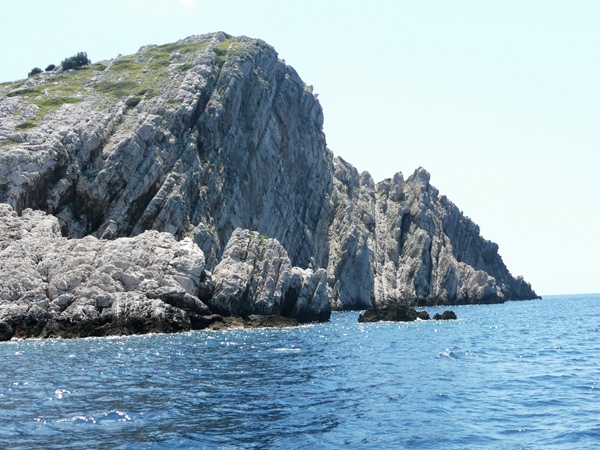
Die Bezeichnung der Kornati-Inseln ist auf die besonderen geologische Begebenheiten in dieser Meeresregion zurückzuführen. Die Untergrund-Beschaffenheit unterscheidet sich nicht besonders von jener des naheliegenden Festlandes, d.h. der Untergrund der Kornaten besteht aus sehr porösem Kalkgestein. Anders als alle anderen Adriainseln weisen die Kornaten zum offenen Meer hin steil abfallende Steilwände (Kliffs) auf. Diese Steilküsten werden von der lokalen Bevölkerung als so-genannte "Kronen" (kroat. krune, ital. corone) bezeichnet, was insbesondere bei seitlicher Betrachtung auffällt. An einzelnen Stellen reicht die Steilküste bis zu 90 m unterhalb des Meeresspiegels (etwa bei den Inseln Piškera und Rasip). Die höchsten, steil in das Meer abfallenden Felsen gibt es auf der Insel Klobučar (82 m ü.M).
Images of Islands Kornati
video Kornati
National Park Kornati - Croatia
Kornati National Park
Kornati National Park Map
Getting there - Krka National Park
In the resorts numerous travel agencies offer an organized trip to the National Park. All visitors of the National Park must pay a fee of 30 kuna. In low season the price is reduced to 20 kuna. Due to the many checks a ticket in any case is necessary. Organized day-trips cost about 210 kuna. These day trips usually crossing, menu and shore excursions with bathing facilities. These trips can be booked in the following places: Dugi Otok, Murter, Veli Iz, Ugljan, [[Island of Pasman | Pasman] (Vodice) and from Zadar and Biograd. The island passage between the islands of Kornat and Smokvica is called official National Park entrance. The Kornati National Park is car free.
In the central administration of the national park in Murter on Murter island and on the island Zut can purchase tickets for the Kornati National Park.
On the islands there is also a tourist office. It is located on the island Ravni Žakan.


